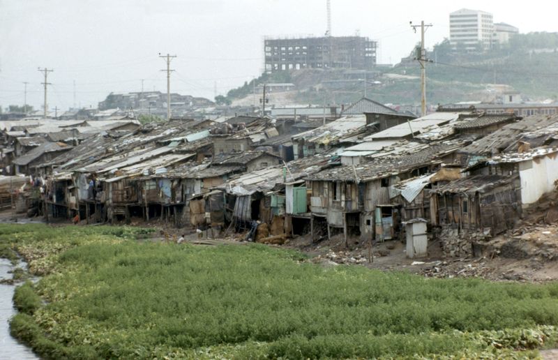
Shanties line the banks of Jungnangcheon in the 1970s. Provided by the Seoul Museum of History. Photographs of Jungnangcheon in the 1970s show shanties packed along the riverbank. The frames of buildings under construction can be seen beyond the low roofs. An exhibition looks back at how the eastern outskirts of Hanyang, once home to royal hunting grounds and horse ranches during the Joseon era, became residential and commercial areas of Seoul.According to the Seoul Museum of History on the 17th, a special exhibition titled 'The City's Boundary, Jungnangcheon' opens that day at its branch, Cheonggyecheon Museum. Based on the 2024 research project 'Cheonggyecheon Research Project 6: Jungnangcheon,' it examines changes in the lower reaches where Cheonggyecheon Stream and Jungnangcheon meet, dividing them into three periods.
■ Hanyang's Hunting Grounds and Gyeongseong's FloodsPart 1 of the exhibition, 'Seongjeosimni and Jungnangcheon,' sheds light on the geography and uses of Jungnangcheon during the Joseon era. At the time, Jungnangcheon formed the boundary between Hanseong-bu and Yangju County in Gyeonggi Province. It was also the eastern end of Seongjeosimni, an area extending about ten ri beyond the capital walls.
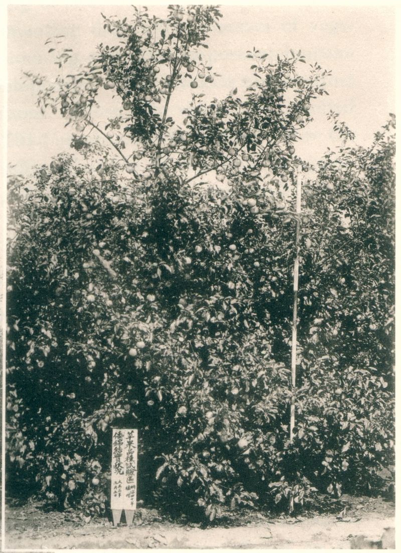
Apple trees at the Ttukseom farm, pictured in a 1915 record. Provided by the Seoul Museum of History. Known as Donggyo (the eastern outskirts), the area was home to state-run horse ranches and military training grounds. Salgoji Bridge spanned the route from Hanyang to the southeastern part of the Korean Peninsula. Construction of the stone bridge began during the reign of King Sejong and was completed during the reign of King Seongjong. 'Hanyang Jeondo,' a map showing Hanyang's topography in the late Joseon period, is also among the exhibition materials.
Part 2, 'Gyeongseong's Boundary, Jungnangcheon,' introduces farms, water facilities and transportation infrastructure in Ttukseom and Janganpyeong during the Japanese colonial period. The Ttukdo Water Supply Station No. 1 Purification Plant supplied tap water to the area inside Seoul's Four Great Gates and to Yongsan from 1908. A photograph of the Ttukseom farm in a 1915 record shows fruit-bearing apple trees and a sign announcing a variety trial.
The Great Flood of Eulchuk Year, which struck the Han River basin four times between July and September 1925, also damaged part of Salgoji Bridge. The bridge was repaired in the 1970s and is now designated a Treasure. Graphics at the exhibition show how Jungnangcheon changed after the flood.
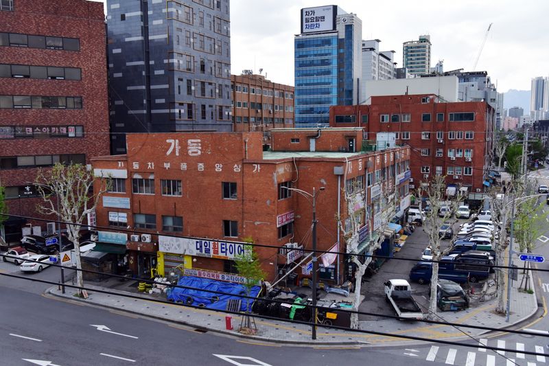
A view of the Janganpyeong Central Auto Parts Market in Seoul. Provided by the Seoul Museum of History. ■ Removal of Shantytowns and Relocation of the Auto Parts MarketPart 3, 'Seoul's Expansion and Jungnangcheon,' focuses on urban development after liberation. It examines how the 1966 Greater Seoul Urban Master Plan, the East Seoul Development Plan and the Janghanpyeong Land Readjustment Project, among other initiatives, changed residential areas and commercial districts in eastern Seoul. It also covers the removal of shantytowns along Jungnangcheon and cases in which tributaries were covered over to create sites for commercial buildings.
In 1982, merchants who sold auto parts along Cheonggyecheon Stream moved to the Jeonnongcheon area. From the mid-1980s, antique shops from Cheonggyecheon Stream, Hwanghak-dong, Ahyeon-dong and elsewhere began settling in the Dapsimni area.
Choi Young-chang, director of the Seoul Museum of History, said, "I hope this exhibition will give citizens an opportunity to take a fresh look at the historical significance of Jungnangcheon, a familiar stream, and to understand how Seoul has changed as a city."
The exhibition is free to visit through March 28 next year in the special exhibition gallery on the first floor of Cheonggyecheon Museum in Seongdong-gu, Seoul. Visiting hours are from 9 a.m. to 6 p.m., with last admission at 5:30 p.m. The museum is closed every Monday, but opens when a Monday falls on a public holiday. It is closed on January 1.
[email protected] Jang In-seo Reporter