LX Hosts Digital SOC Land Conference on Detecting Changes to National Territory with AI
- Input
- 2026-11-05 15:20:20
- Updated
- 2026-11-05 15:20:20
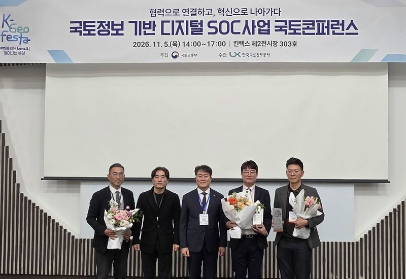
[Financial News] Ways to sort out the tangled land boundaries and ownership rights beneath roads and railways, and to use AI to detect changes to the national territory, were discussed at a gathering.
According to Korea Land and Geospatial InformatiX Corporation (LX) on the 5th, the Ministry of Land, Infrastructure and Transport (MOLIT) and LX held the Digital SOC Land Conference that day at KINTEX in Goyang, Gyeonggi Province, sharing best practices in land management for national infrastructure. The conference was organized as a forum for relevant institutions to explore ways to cooperate in efficiently managing national infrastructure such as roads and railways and making better use of land assets.
Presentations focused on on-the-ground cases. Icheon City administrative officer Lee Yul-jae presented ways to organize highway sites with complex ownership rights, while LX Deputy General Manager Lee Ho-seong discussed efficient management of land assets for national infrastructure. LX Senior Staff Member Kim Tae-jin introduced ways to use the AI ‘LandXI’ to monitor and detect changes to the national territory, and researcher Lee Si-hyeong of the Spatial Information Research Institute presented ways to identify unused land through geospatial analysis and manage it. To strengthen cooperation, LX presented plaques of appreciation to officials from the Ministry of National Defense, Icheon City Hall, Korea Rail Network Authority and Korea Land and Housing Corporation (LH).
LX has used cadastral surveying and geospatial technologies to establish land boundaries and ownership rights needed for SOC projects, and has supported the swift resolution of land disputes. Since being designated a ‘specialized land compensation agency’ following an amendment to the Land Compensation Act in May, it has also taken on land compensation work for public-interest projects. In July, it was entrusted with land compensation work for the Dunpo Old Downtown Connecting Road Construction Project in Asan-si, South Chungcheong Province, its first public compensation project since the designation. The work involves acquiring land and other property incorporated into the project and compensating for losses. LX said it would set up a new dedicated compensation team and use AI-based object detection, drones and geospatial information convergence technologies to improve the accuracy and speed of its surveys.
Kim Tae-hyeong, director of MOLIT’s Spatial Information System Division, said, “The government will establish an institutional framework and strengthen cooperation with relevant institutions to enable accurate management of land conditions for national infrastructure and data-driven decision-making.”
LX Vice President Lee Ju-hwa said, “As LX is actively supporting efforts to enhance the value of land assets and prevent ownership disputes, drawing on its expertise in cadastral surveying and geospatial information, we will do our utmost to ensure that our cooperation produces tangible results.”
[email protected] Jeong Gyeong-su Reporter