Kim Jang-hoon’s First Performance on Gyeollyeolbiryudo Canceled by Rough Seas ... “But It Raised Awareness of the Value of Maritime Territory”
- Input
- 2026-10-26 10:52:35
- Updated
- 2026-10-26 10:52:35
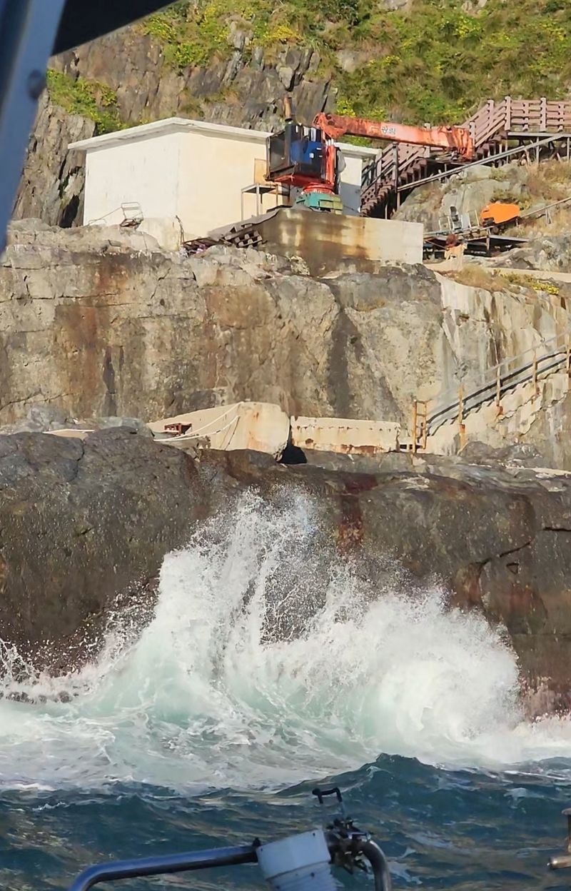
South Chungcheong Province said on the 26th, “We had planned to hold a special performance with singer Kim Jang-hoon at noon that day at the navigational aids management office on Bukgyeongnyeolbido, in Geunheung-myeon, Taean County, but poor weather conditions prevented us from landing on the island.”
Kim Jang-hoon, who has continued his efforts to defend Dokdo, planned the performance to mark Dokdo Day (October 25) and raise awareness of the value of South Korea’s maritime territory and Gyeollyeolbiryudo. He had planned to perform for about an hour with the band “Hanguk Saram,” without an audience, and livestream the show on his official YouTube channel and the province’s official channel, “Chungnam TV.”
Kim Jang-hoon’s team decided to withdraw after determining that the high waves made it difficult to dock safely and land on the island.
South Chungcheong Province said that although the performance did not go ahead, it considered the preparations meaningful because they helped inform the public about Gyeollyeolbiryudo’s value and the importance of maritime territory. Kim Jang-hoon’s team plans to try to land on the island again in November, with details such as the schedule and format of the renewed effort to be announced later.
Gyeollyeolbiryudo lies 55 km off the coast, west of Anheung Port in Taean County. It got its name because it looks like birds flying in a line. The archipelago consists of three main islands—north, west and east—along with smaller islets. Its total area is 514,603 m2, about 2.7 times the 187,554 m2 area of the Liancourt Rocks. Seogyeollyeolbido, the westernmost island in the central Yellow Sea, is a territorial-sea base point that determines the extent of the territorial sea (12 nautical miles) and the exclusive economic zone (200 nautical miles; EEZ). It is considered a strategic stronghold for protecting maritime territory and fishery resources.
South Chungcheong Governor Park Soo-hyun also visited Gyeollyeolbiryudo on the 10th to check on progress of a port development project scheduled for completion by 2030. Park referred to an attempt by Chinese nationals to buy privately owned Donggyeollyeolbido and Seogyeollyeolbido, unlike state-owned Bukgyeongnyeolbido, and called for the government to purchase the islands. Donggyeollyeolbido and Seogyeollyeolbido are currently designated and managed as areas where foreign land transactions require permits.
A South Chungcheong Province official said, “It’s unfortunate that weather conditions prevented us from holding the performance, but safety comes first. We will continue to promote the symbolic value of Gyeollyeolbiryudo and the importance of safeguarding maritime territory in various ways.” Meanwhile, port development is underway on Gyeollyeolbiryudo. The island was designated a national-managed coastal port on July 4, 2022. A project is underway to build a 66-meter breakwater revetment, a 135-meter pier and one helipad, among other facilities, by 2030, at a total cost of 47.8 billion won funded entirely by the national government. Since national-managed coastal ports are primarily intended to manage territorial waters and provide shelter for ships, the project is expected to improve access to the island, which has been difficult to reach even in bad weather like this.
[email protected] Kim Won-jun Reporter