Heavy rain of up to 200 mm in Jeju, heavy rain along the southern coast... beware flooding and wind damage
- Input
- 2026-10-24 16:43:23
- Updated
- 2026-10-24 16:43:23
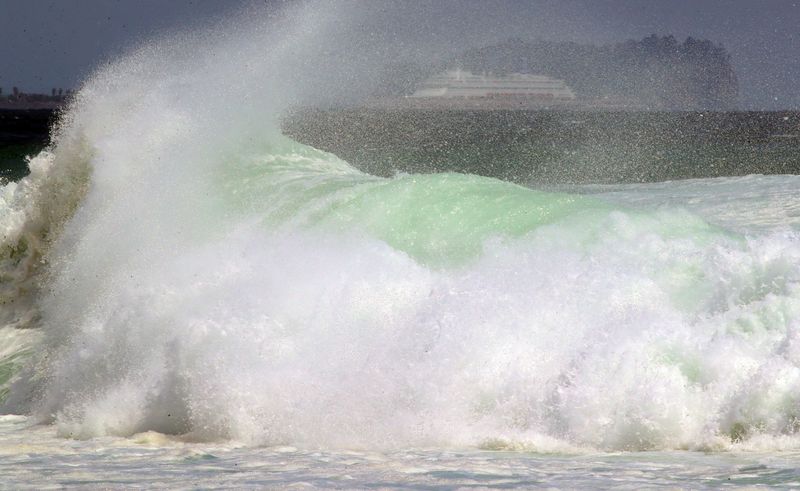
Heavy rain is expected through Sunday the 25th, especially in Jeju and along the southern coast. At least 200 mm of rain is forecast in Jeju’s mountainous and mid-mountain areas, and high waves exceeding 5 m are expected south of Jeju and in the offshore waters of the South Sea under the influence of Typhoon Champi, the 30th typhoon of the year. Strong winds are also forecast for Jeju, potentially disrupting flights.
According to weather information released by the Korea Meteorological Administration at 4:30 p.m. on the 24th, rainfall through the 26th is forecast at 80–150 mm in Jeju, 30–80 mm along the coasts of Busan, Ulsan and South Gyeongsang Province, and 20–60 mm in Gwangju and South Jeolla Province. Some areas may see heavy rainfall of at least 200 mm in Jeju’s mountainous and mid-mountain areas, at least 100 mm along the South Gyeongsang coast, and at least 80 mm along the South Jeolla coast.
Rainfall of 20–60 mm is forecast for inland South Gyeongsang, 10–50 mm for southern North Gyeongsang, and 5–40 mm for central and northern North Gyeongsang, Ulleungdo and Dokdo. Southeastern North Jeolla is forecast to receive 5–30 mm, with 5–10 mm in the rest of the province. Around 5 mm of rain may fall in parts of central and southern Gangwon State and the Chungcheong region.
Rain is expected to be concentrated in the early hours of the 25th. Jeju’s mountainous and mid-mountain areas will see heavy rain of 20–30 mm per hour from 3 to 6 a.m., while the rest of Jeju will receive around 20 mm per hour. Around 20 mm per hour is also expected in South Jeolla and along the South Gyeongsang coast from 3 to 6 a.m.
The rain is expected to gradually ease from the night of the 25th, but continue until the early hours of the 26th along Gangwon State’s East Sea coast and in its mountainous areas, along the South Jeolla coast, and along North Gyeongsang’s East Sea coast and in its northeastern mountainous areas. Some parts of Busan, Ulsan, the South Gyeongsang coast and Jeju may see rain through the morning of the 26th.
The Korea Meteorological Administration urged people to take extra care, warning that autumn leaves could clog drains and cause flooding in low-lying areas. As rainwater may back up through sewers and storm drains, people should prepare for flooding and avoid dangerous areas such as riverside paths and underpasses. They should also watch out for landslides, mudslides and falling rocks.
Strong winds and high waves are also expected at sea under the influence of Typhoon Champi.
Strong winds of 8–18 m/s and waves of 1.5–4 m are expected through the 26th in waters around Jeju, the offshore waters of the South Sea, and the southern offshore waters of the southern West Sea. Waves could reach more than 5 m in the southern offshore waters of Jeju and the outer offshore waters of the eastern South Sea.
In particular, the high seas advisory for the outer waters south of Jeju could be changed to a typhoon alert on the morning of the 25th, and the advisory for the outer offshore waters of the eastern South Sea could be changed to a typhoon alert that afternoon. However, whether and when warnings take effect may vary depending on the typhoon’s path.
Jeju is expected to see gusts of at least 20 m/s through the 26th, with gusts of at least 25 m/s in mountainous areas. From the morning of the 25th, winds are also expected to strengthen in northern and western Jeju City, potentially prompting a strong-wind advisory. Strong winds could disrupt flights, so airport users should check flight information in advance.
From the night of the 25th, strong winds with gusts of around 15 m/s are expected in parts of most regions across the country.
Powerful swells will continue to hit the southern coast and Jeju’s shores for the time being, and from the afternoon of the 25th, high waves may overtop breakwaters or coastal rocks in some areas along the East Sea coast.
Spring tides, when the moon’s gravitational pull raises sea levels, will begin on the 26th. Sea levels will rise further around high tide, bringing a risk of flooding, particularly in low-lying coastal areas.
Temperatures will be above average despite the rain. On the 25th, morning lows nationwide are forecast at 8–18 degrees Celsius and daytime highs at 19–24 degrees. On the 26th, morning lows will be 11–18 degrees and daytime highs 19–25 degrees.
However, on the 25th, the temperature difference between day and night in the Seoul metropolitan area and inland Gangwon State is expected to widen to around 15 degrees. The Korea Meteorological Administration urged people to take care of their health amid the large daily temperature swings.
[email protected] Lee Bomi Reporter