Typhoon Champi’s effects: Rain in Jeju from midday on the 23rd... at least 150 mm in mountainous areas
- Input
- 2026-10-23 06:19:08
- Updated
- 2026-10-23 06:19:08
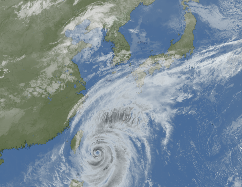
【Financial News, Jeju = Reporter Jeong Yong-bok】 Rain is expected to begin in Jeju from midday on the 23rd and continue through the weekend as a result of the indirect effects of Typhoon No. 30, Champi. Heavy rain of at least 150 mm is forecast in mountainous and mid-mountain areas through the 25th, while waves as high as 6 m are expected in waters south of Jeju.
According to the Jeju Provincial Meteorological Administration on the 23rd, rain will begin in Jeju between noon and 3 p.m. that day. Cloudy skies and rain are expected to continue on the 24th and 25th, with some areas likely to see rain through the early hours of the 26th.
Rainfall from midday on the 23rd through the 25th is forecast at 50–100 mm across Jeju Island. Due to topographical effects, some mountainous and mid-mountain areas are expected to receive at least 150 mm.
The rain is expected to develop as moisture flows in from the south under the influence of northbound Typhoon Champi and the surrounding pressure system. Rain that begins in Jeju is expected to spread to the southern regions of the country.
Typhoon Champi is expected to pass through waters east of Taiwan, move north, and then change course toward Japan’s Kyushu region. The Korean Meteorological Administration considers a direct landfall on the Korean Peninsula unlikely, but expects indirect effects, including strong winds and rough seas, in Jeju and the waters off the southern coast.
The typhoon is expected to come closest to South Korea around the 25th. Even if its center does not approach Jeju’s land area, some waters to the south could enter its radius of gale-force winds.
Conditions at sea are expected to worsen in particular. The Jeju Provincial Meteorological Administration forecast waves of up to 5.5 m in the outer waters south of Jeju Island on the 24th, rising to as high as 6 m on the 25th.
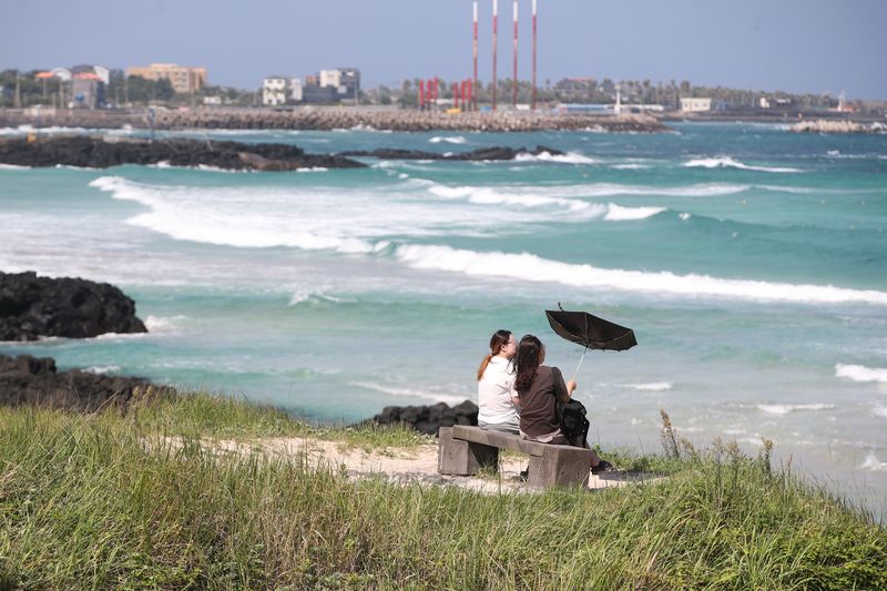
Winds in the outer waters south of Jeju are forecast to reach 14–22 m/s on the 25th. Waves of up to 5 m are also expected in the waters off the southern and eastern coasts of Jeju Island from the 25th through the morning of the 26th. Waves as high as 7 m are forecast in the East China Sea on the 24th and 25th.
Winds are also expected to strengthen over land from the afternoon of the 23rd. The Korean Meteorological Administration said gusts could reach at least 55 km/h in Jeju and strong winds of at least 70 km/h could affect mountainous areas.
Passengers using flights and ferries to and from Jeju should check service information. People near the coast, on breakwaters and on rocky shores should also watch out for accidents caused by swells.
The Jeju Horse Festival is scheduled to take place in Aewol-eup, Jeju City, this weekend, while the Suwolbong Geotrail is planned for Hankyeong-myeon. Participants in outdoor events should check operating notices in light of rain, strong winds and changing marine weather conditions.
If Typhoon Champi affects waters off the southern coast, it could become an unusual typhoon in terms of timing as well. According to the Korean Meteorological Administration, the latest typhoon on record to affect South Korea was Zeb, from October 16 to 18, 1998. If Champi is classified as a typhoon affecting the country, it will break that record.
However, rainfall in Jeju and the areas affected by strong winds and rough seas could vary depending on where the typhoon changes direction near Taiwan, how quickly it moves, and how its strength changes.
[email protected] Jeong Yong-bok Reporter