“Torrential rain like in summer?” ... Weekend weather on ‘red alert’ as Typhoon Champi moves north
- Input
- 2026-10-21 15:27:34
- Updated
- 2026-10-21 15:27:34
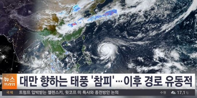
[Financial News] Attention is focused on the potential impact on the Korean Peninsula this weekend as Super Typhoon No. 30, Champi (CHAMPI), moves north.
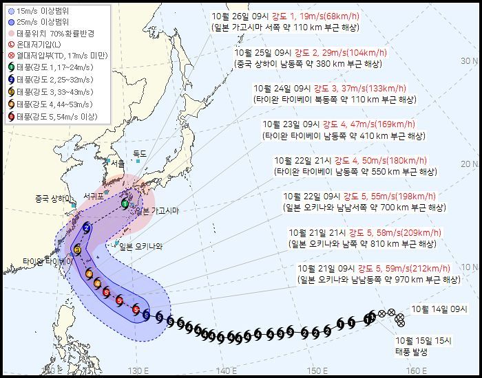
According to the Korean Meteorological Administration on the 21st, as of 9 a.m. that day, Champi was moving west-northwest at 28 km/h over waters about 970 km south-southeast of Okinawa, Japan. It had a central pressure of 900 hPa and maximum sustained winds near its center of 59 m/s (212 km/h), maintaining the highest level, “Intensity 5,” in the Korean Meteorological Administration’s typhoon intensity classification. Its radius of strong winds alone reached 510 km, making it a powerful and threatening system whose eye was clearly visible in satellite images.
Champi is expected to maintain its super-strong intensity through the 22nd before gradually weakening as it reaches waters east of Taiwan. It is then forecast to turn northeast and pass over waters about 380 km southeast of Shanghai, China, on the morning of the 25th, before approaching waters about 280 km south of Seogwipo, Jeju (about 110 km west of Kagoshima, Japan), on the morning of the 26th. By then, the typhoon is expected to have weakened significantly to Level 1 strength, with maximum winds of 19 m/s, before making landfall on Japan’s Kyushu.
The likelihood of the typhoon making a direct landfall on the Korean Peninsula is low. As late October sets in, sea surface temperatures have fallen below 26°C, and cold continental high pressure moving down from the northwest is holding over the Korean Peninsula, acting as a barrier to the typhoon’s northward advance.
In fact, temperatures across the country have been plunging sharply since cold air from the northwest began moving in forcefully on the afternoon of the 21st. Seoul’s morning low on the 22nd is forecast to drop to 5°C, with the perceived temperature staying around 0°C. The Korean Meteorological Administration issued cold wave advisories effective 9 p.m. that day for parts of Gyeonggi, Gangwon and Chungcheong, as well as inland areas in the south.
However, it is too early to relax even if the typhoon avoids making landfall inland. As it continues to push large amounts of water vapor north from the south, strong winds and heavy rain are expected over the weekend, particularly in the southern regions.
According to the Korean Meteorological Administration’s medium-range forecast, rain will begin on the 24th in South Jeolla, South Gyeongsang and Jeju, then spread across the Chungcheong region and all of the southern regions on the 25th, continuing through the morning of the 26th. Strong winds and very high waves are expected around Jeju Island and in the South Sea, so particular caution will be needed for maritime safety.
A Korean Meteorological Administration official urged the public to stay informed, saying, “The typhoon’s track remains highly uncertain, with the 70% probability radius for its forecast position on the 26th reaching 440 km. The timing and areas of rainfall may change depending on the typhoon’s track and changes in its intensity, so please check the latest weather information as it is issued.”
[email protected] Moon Young-jin Reporter