“Drones Take Flight for Wildfires in Rugged Terrain and at Night” ... Forest Safety Corporation Conducts Real-World Drone Response Training
- Input
- 2026-10-08 12:55:52
- Updated
- 2026-10-08 12:55:52
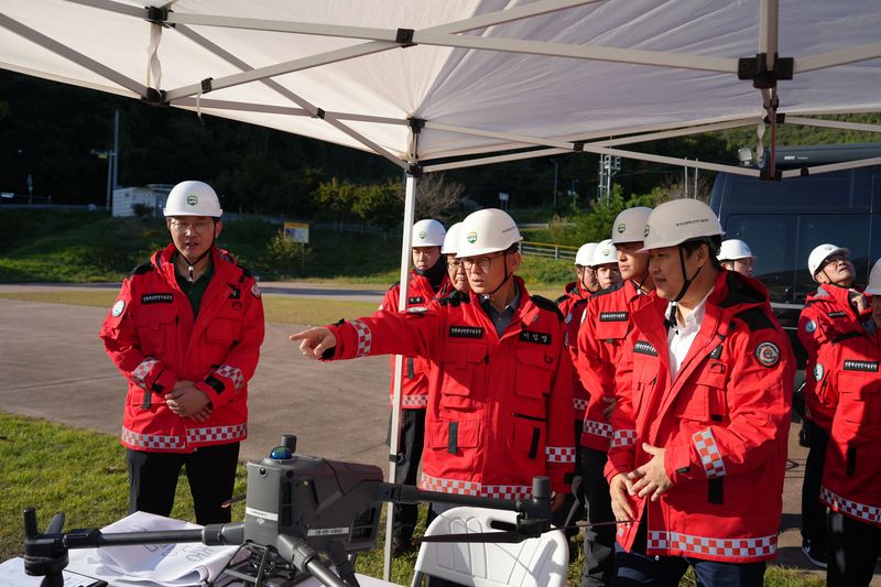
The Forest Safety Corporation said on the 8th that it had held the “Field Disaster Response Drone Capacity-Building Training in Preparation for Forest Disasters” over two days and one night, on the 7th and 8th, in areas of Gongju, South Chungcheong Province, and in the corporation’s lecture hall, jointly with the Central Regional Office of the Korea Forest Service and the National Institute of Forest Science.
The training was organized to strengthen the role of drones in quickly identifying fire lines, remaining hotspots and the extent of damage at wildfire sites in rugged terrain that is difficult for firefighting crews to access, or during nighttime wildfires, and providing firefighting agencies with accurate geospatial information.
The training was divided into outdoor flight exercises on the first day and indoor analysis exercises on the second. Key topics included the role and operation of drones during wildfires, honing flight skills for responding to nighttime wildfires, and practical flight exercises in terrain reconnaissance and fire-line detection using thermal imaging cameras.
The corporation and related agencies plan to share drone operating techniques and field experience through the training, while continuing to advance their specialized operational capabilities so they can conduct precise searches without blind spots even in high-risk settings such as nighttime and rugged terrain.
The chairman said, “The success or failure of a wildfire response depends on how quickly and accurately information from the scene can be obtained. Since drones are the fastest ‘eyes’ at wildfire sites that are difficult for people to reach, we will continue to strengthen a prevention-focused forest disaster safety management system through cooperation with related agencies.”
Meanwhile, forest authorities have recently been accelerating efforts to advance drone technology by combining drones with artificial intelligence (AI) and autonomous flight capabilities, moving beyond simple reconnaissance. One example is developing systems in which AI algorithms independently detect minute heat sources from remaining embers in footage captured by thermal imaging cameras and automatically generate coordinates, or analyze smoke distribution to predict the path of a wildfire’s spread. Such information and communications technology (ICT)-based drone operations are emerging as a key pillar in helping command teams make swift and accurate decisions at wildfire scenes.
[email protected] Wonjun Kim Reporter