Where Is My Neighborhood Earthquake Shelter? Find It on NAVER Map, Kakao Map and T Map
- Input
- 2026-09-30 13:43:54
- Updated
- 2026-09-30 13:43:54
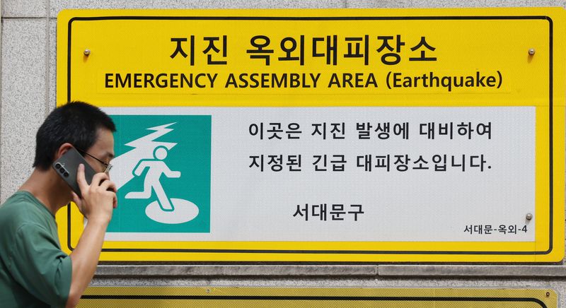
Where should you evacuate in the event of an earthquake? Earthquake evacuation sites near your home, school or workplace can be found by searching for "earthquake" on the Emergency Ready App, NAVER Map, Kakao Map or T Map. A total of 11,254 outdoor earthquake evacuation sites have been designated nationwide.
The Ministry of the Interior and Safety (MOIS) announced on the 30th that it will hold a public participation campaign throughout October encouraging people to locate and visit earthquake and tsunami evacuation sites. The campaign is intended to help residents learn about nearby shelters and evacuation routes in advance.
Outdoor earthquake evacuation sites are large, open spaces such as school grounds and parks. During an earthquake, people should protect themselves by taking cover under a desk. Once the shaking stops, they should shut off the electricity and gas, then open doors to secure an exit. When leaving a building, use the stairs instead of an elevator. Outside, move away from buildings and head to an open area such as a school ground or park.
People in coastal areas should also identify tsunami evacuation sites in advance. A total of 652 sites have been designated across four cities and provinces: Busan, Ulsan, Gangwon and North Gyeongsang. If a tsunami alert is issued, move away from the coast to higher ground and follow evacuation signs.
MOIS will run an event to help people find evacuation sites from October 1 to 30. From October 12 to 30, it will also hold a campaign in which participants visit evacuation sites in person and verify their visits. If an evacuation site sign is damaged or its location is incorrect on a map, reports can be filed through Safety e-Report from October 26 to November 30.
October 19–25 will be observed as Earthquake Safety Week. Promotional booths will be set up at four locations, including Gangnam Square Plaza in Seoul, Daejeon Complex Terminal, Mangwon Hangang Park in Seoul and the Culture Sharing Center at Pusan National University Station in Busan. The program will also include training for local government officials, joint tsunami tabletop exercises with relevant agencies, and earthquake safety education and evacuation drills for children.
The government is maintaining the earthquake crisis alert level "Caution" in connection with the ongoing sequence of earthquakes around Haenam County. While monitoring earthquake activity, it plans to inspect the emergency contact networks and situation-sharing systems of local governments and relevant agencies, as well as the management status of evacuation sites and major facilities.
[email protected] Lee Bo-mi Reporter