Typhoon Surigae Develops into an 'Intensity 3' Storm with Maximum Winds of 37 m/s; Too Early to Determine Direct Impact on Jeju
- Input
- 2026-09-26 07:53:37
- Updated
- 2026-09-26 07:53:37
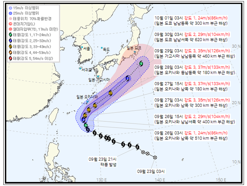
[Financial News, Jeju — Reporter Jung Yong-bok] Typhoon No. 26, Surigae, is expected to develop into an 'intensity 3' typhoon with maximum winds of 37 m/s on the 27th. Its projected path turns northeast near Okinawa toward waters south of Japan, making it too early to conclude that Jeju will be directly affected at this point.
As of 3 a.m. on the 26th, according to the Korean Meteorological Administration, Surigae was moving north-northwest over waters approximately 510 km south of Okinawa, with a central pressure of 990 hPa and maximum winds of 24 m/s. It was moving at 15 km/h.
The storm is expected to strengthen rapidly from the afternoon of the 26th. The Korean Meteorological Administration forecast that by 3 p.m. that day, Surigae's central pressure would drop to 980 hPa and its maximum winds would reach 29 m/s, or 104 km/h.
By 3 a.m. on the 27th, the storm is expected to strengthen to a central pressure of 970 hPa and maximum winds of 35 m/s. By 3 p.m., it is forecast to develop further, reaching a central pressure of 965 hPa and maximum winds of 37 m/s. The radius of strong winds is also expected to expand to 210 km.
Since this year, the Korean Meteorological Administration has classified typhoon intensity on a numerical scale from 1 to 5. 'Intensity 3' refers to a typhoon with maximum winds of at least 33 m/s but less than 44 m/s, corresponding to the former 'strong' category.
Surigae is forecast to move as far as waters south of Okinawa on the 27th before turning northeast. On the 28th, it is likely to move to waters east of Okinawa and then continue northeast along waters south of Japan.
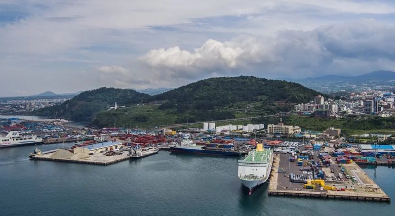
At present, the typhoon's projected center is not headed directly toward Jeju. However, uncertainty about its track increases as the forecast period lengthens.
The 70% probability radius for the typhoon center's projected position, presented by the Korean Meteorological Administration, will expand from 110 km on the afternoon of the 27th to 130 km on the morning of the 28th and 190 km on the morning of the 29th. It will widen to 440 km on the morning of the first day of next month. A 70% probability radius means there is a 70% chance that the typhoon's center will be located within that range.
Jeju is experiencing continued rain and high waves during the Chuseok holiday return period, separate from the typhoon.
The Jeju Regional Meteorological Office forecast 20–60 mm of rain across Jeju through the evening of the 26th. On the 27th, some areas—especially south of Hallasan—could receive 5–10 mm of rain between the morning and late afternoon.
Waves in the waters off Jeju are expected to reach 1.0–2.5 m, while some offshore waters, including the inner offshore waters southwest of Jeju and the outer offshore waters to the south, could see waves as high as 3 m. Gusty winds and thunder and lightning are also expected in some areas at sea.
[email protected] Jung Yong-bok Reporter