Drones to Survey 71,401 ha Across Nine Jeju Townships and Towns... Winter Vegetable Supply Forecasts to Be Made at the Field-Parcel Level
- Input
- 2026-09-14 09:59:55
- Updated
- 2026-09-14 09:59:55
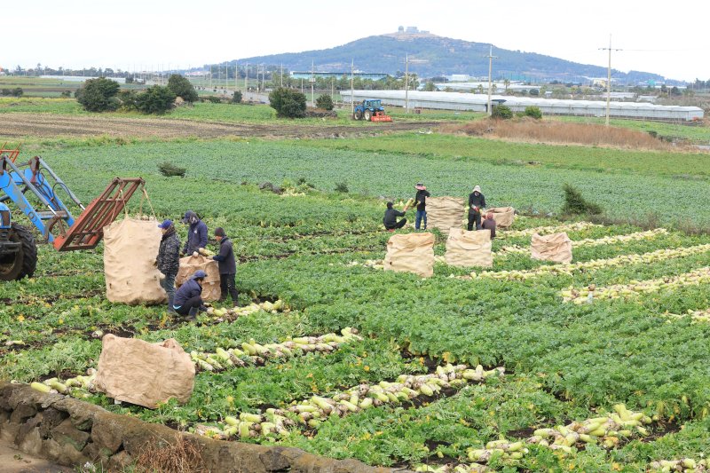
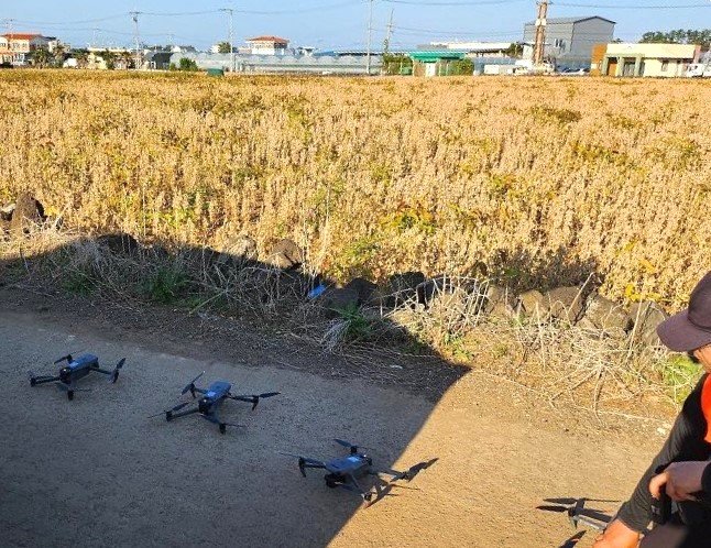
【Financial News Jeju = Jeong Yong-bok, Reporter】 A large-scale agricultural monitoring project is being launched in Jeju’s nine major winter vegetable production areas, covering 71,401 ha. Drones will identify the crops actually grown in each field parcel, while radish and onion fields will be photographed repeatedly through the harvest season.
On the 14th, the Korea Rural Economic Institute (KREI) said it had commissioned the “2026 Survey of Winter Vegetable Cultivation and Harvest Areas in the Jeju Region Using Aerial Photography” and was proceeding with the selection of a contractor. The base project cost, including value-added tax, is 648.7 million won. The contract will run from the date of signing through June 15 next year.
The project is not simply about taking drone photographs. Based on the images, KREI will build parcel-level spatial data on the actual cultivated area, crop types, and harvesting progress of Jeju’s winter vegetables. The data will be used for agricultural outlook monitoring and supply-and-demand analysis.
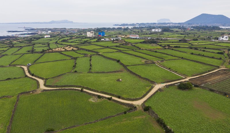
The survey covers Gujwa-eup, Aewol-eup, Jocheon-eup, Hangyeong-myeon, and Hallim-eup in Jeju City, as well as Daejeong-eup, Seongsan-eup, Andeok-myeon, and Pyoseon-myeon in Seogwipo City. Andeok-myeon has been newly added this year.
The total survey area is 71,401 ha. Seongsan-eup is the largest at 13,291 ha, followed by Daejeong-eup at 12,668 ha, Gujwa-eup at 11,700 ha, Hangyeong-myeon at 9,080 ha, and Pyoseon-myeon at 8,111 ha. The survey also includes Aewol-eup at 5,071 ha, Jocheon-eup at 4,832 ha, Hallim-eup at 3,338 ha, and Andeok-myeon at 3,310 ha.
The images used to identify crop types must generally have a spatial resolution of 1 cm or less. At least one high-resolution image will be secured for each field parcel, with additional photography required when identification is difficult. If bad weather or flight-approval issues make drone operations impossible, surveyors will visit the site in person to obtain photographs and location data for the parcel.
The classification categories have also been subdivided. Onions, garlic, radishes, carrots, cabbages, mandarins, potatoes, and scallions will be identified separately, along with other crops, protected-cultivation areas, fallow land, and non-cultivated land. When multiple crops are grown in one parcel, the areas planted with the main crop and intercropped crops will be calculated separately.
Measures have also been introduced to reduce the subjectivity of image analysts. The same parcel will be checked at least twice by different analysts, and if numerous misclassifications are found for a crop, the entire category will be reclassified. If an automated classification model is used, the model and its performance must also be disclosed.
The most notable aspect of the survey is that it goes beyond measuring cultivated areas to track actual harvesting progress.
For radishes and onions, cultivated parcels will first be identified, after which drones will be flown again during the harvest season. Radish surveys will cover seven areas—Gujwa-eup, Jocheon-eup, Hangyeong-myeon, Daejeong-eup, Seongsan-eup, Andeok-myeon, and Pyoseon-myeon—while onion surveys will cover three: Gujwa-eup, Hangyeong-myeon, and Daejeong-eup.
Both crops will be photographed four times during the harvest season. By comparing earlier and new images, analysts will calculate the area already harvested and the area remaining in the fields. Parcels where harvesting is underway will be recorded based on the crop area remaining at the time of photography.
The analysis schedule was also set tightly to support agricultural outlook monitoring. The first cultivated-area survey results are due in a draft by December 11 and in final form by December 18. Results from the second cultivated-area survey are due by January 22 next year. For radish and onion harvested areas, analysis results must be submitted within four days of each photography session.
The deliverables will be more than simple statistical tables. The project will create spatial data, aerial imagery, and databases showing the location, crop type, and cultivated area of each parcel. It will also produce crop-specific distribution maps that can be used directly in agricultural outlook reports.
A separate accuracy-verification process is also planned. Once cultivated-area classification is complete, surveyors will visit 1,000 randomly selected parcels and compare the crops classified from drone footage with those actually being grown in the field. If significant errors are found, the relevant area or crop category must be photographed again or reclassified.
The reason a national research institute is tracking Jeju’s winter vegetable production sites in such detail lies in the distinctive supply-and-demand volatility of winter vegetables.
According to an analysis by the Jeju Agricultural Research and Extension Services, wholesale prices for radishes and carrots from the 2024 harvest rose 68% and 70%, respectively, from the previous year because of supply shortages. By contrast, major winter vegetables from the 2025 harvest faced weak prices as increased production expanded supply. Small changes in production affect not only farm-gate prices and farm income but also consumer prices and the volume of stored and shipped produce.
Jeju Special Self-Governing Province is also operating its own monitoring network to estimate production in advance. This year, it surveyed approximately 500 farms and 31 seed and distribution companies about planting intentions and seed applications for major crops, including winter radishes, carrots, cabbages, broccoli, and onions.
The resulting system first identifies what farmers plan to plant, forecasts the scale of planting through seed demand, and then verifies the actual cultivated area using KREI’s aerial imagery.
KREI has also set a goal of using the data secured through this project to prepare agricultural outlook reports and conduct supply-and-demand analyses. The final deliverables must include the project’s achievements and limitations, future improvement measures, and plans for using the spatial data.
The key question is how much the precise information obtained through an investment of approximately 650 million won will accelerate actual policy decisions.
Even if the accuracy of cultivated and harvested area estimates improves, production and prices are affected by numerous variables, including crop conditions, weather, inventories, consumption, and imports. The project’s success will depend on how much the drone survey data improve existing production forecasts and how effectively they are used in supply-and-demand policy decisions, such as regulating shipments from production areas and determining stockpiling or purchasing measures.
[email protected] Jeong Yong-bok Reporter