"Dry Forests Became Tinder": Massive Wildfires Fueled by Heatwaves and Drought [Climate Crisis as a Disaster 3]
- Input
- 2026-09-07 09:00:00
- Updated
- 2026-09-07 09:00:00
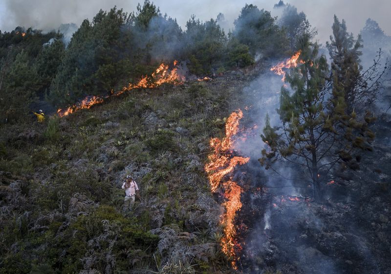
The climate crisis is bringing heatwaves, droughts, wildfires, and torrential rains into our living spaces as natural disasters. We examined the process by which wildfires growing in dry forests and rain falling on burnt mountainous areas spread to cause damage around residential areas, roads, and rivers.
[Financial News] Heatwaves, droughts, wildfires, and heavy rains are emerging as complex disasters that amplify damage within a single living area. When high temperatures, dryness, and strong winds overlap, even a small spark can spread into a massive wildfire, and burnt mountainous areas lead to debris flows and damage around rivers during torrential downpours. Domestic and international cases demonstrate that disaster response must not end with wildfire suppression but must extend to the management of mountain slopes, valleys, and areas surrounding residential zones.
The World Meteorological Organization (WMO), an agency under the United Nations, announced on the 12th of last month that while several countries in the Northern Hemisphere (regions north of the equator, such as Korea, China, Japan, Europe, and North America) were experiencing extreme heatwaves, persistent droughts, and dangerous wildfires, other regions suffered casualties from heavy rains and floods. Last July was the hottest July on record, along with July 2024, and global sea surface temperatures were also the highest ever for July.
Western Europe experienced its hottest June and July on record. In France, Spain, parts of Germany, and the UK, the dry weather that had persisted since spring intensified into July. During the same period, the WMO warned of risks of heavy rain, landslides, and flash floods in India, Pakistan, Nepal, Bangladesh, Bhutan, Myanmar, and parts of Southeast Asia.
The simultaneous occurrence of high temperatures and heavy rain is due to stagnant atmospheric flow and the supply of water vapor. Areas where high pressure lingers for a long time become hot and dry, while areas affected by low pressure, monsoons, and typhoons may experience heavy rainfall in a short period of time.
High temperatures, dryness, and strong winds facing the Yeongnam wildfires
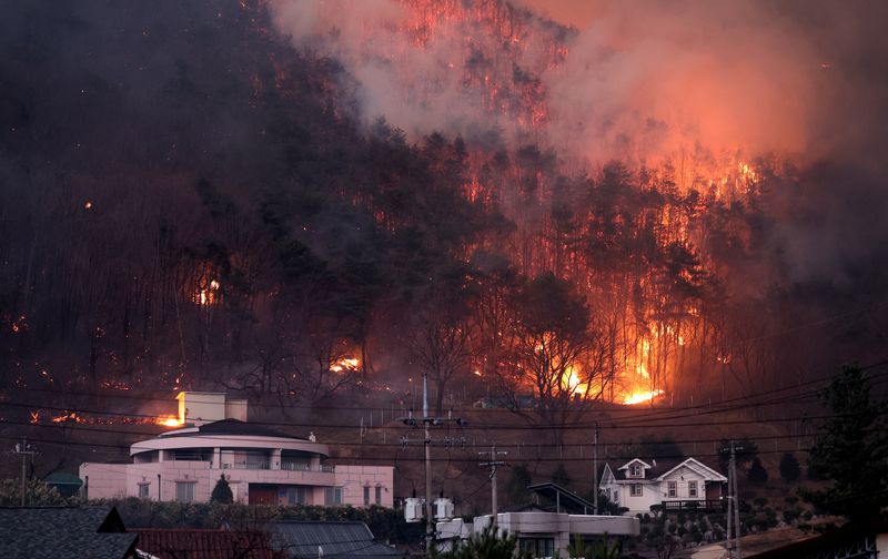
Last year's wildfire damage in Korea also intensified under conditions where high temperatures, dryness, and strong winds overlapped. The Presidential Committee on Climate Change and the Korean Meteorological Administration announced in the '2025 Abnormal Climate Report' last March that Korea experienced record-breaking heatwaves, torrential rains, the worst drought in 108 years, and the largest wildfire damage in history last year.
According to the report, five large-scale forest fires occurred simultaneously across the country between March 21 and 26 of last year. The damaged forest area was 105,084.33 hectares, which is larger than the combined area of 147,100 soccer fields. During this period, the national average temperature was 14.2 degrees Celsius, the highest recorded for that time, and the relative humidity in the Gyeongsangbuk-do region was about 15 percentage points lower than the average year.
Temperature and humidity levels explain the conditions that cause wildfires to spread. High temperatures cause the moisture in fallen leaves, branches, and grass to evaporate quickly, while low humidity causes even small amounts of fuel within the forest to dry out easily. When strong winds are added to this, the flames spread rapidly along ridges and valleys.
On March 25 of last year, the daily maximum instantaneous wind speeds were 27.6 m/s in Hahoe, Andong, 21.9 m/s in Oksan, Uiseong, and 20.4 m/s in Danbuk, Uiseong. As hot and dry air flowed in carried by strong westerly winds, conditions were created that made it easy for wildfires to spread.
The wildfire in Gyeongsangbuk-do was extinguished 149 hours after ignition, and the affected area was tallied at 45,157 hectares. Twenty-four people died in areas including Andong and Yeongdeok County, and 2,412 facilities, including homes, were burned down.
Wildfires often start due to human negligence, such as accidental fires started by hikers, burning activities, or cigarette butts. However, regardless of the cause of ignition, the scale of damage is influenced by the dryness of the forest, wind speed and direction, topography, and distance from residential areas. When strong winds blow while fallen leaves and grass are parched, flames spread rapidly along ridges and valleys.
In areas where forests and residential areas are close together, the speed of spread is directly linked to the evacuation time. If flames cross a ridge and descend toward villages and roads, residents face smoke, heat, and blocked roads. High temperatures, dryness, and strong winds act as conditions that not only increase the likelihood of wildfires but also exacerbate damage once a fire starts.
Los Angeles Wildfires, Dry Wind After Wet Winter
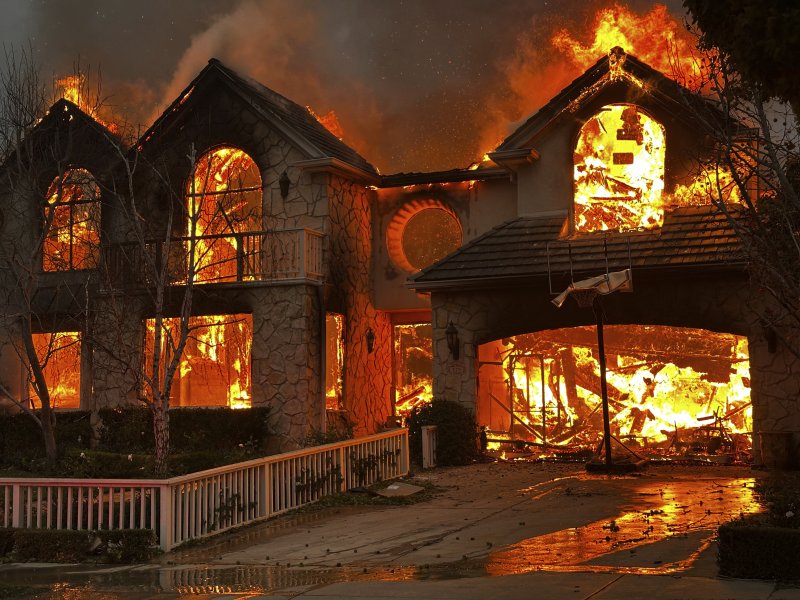
There are cases overseas as well where high temperatures and dryness following a rainy season have increased the risk of wildfires. When it rains sufficiently, grass and shrubs grow rapidly in the mountains and fields. Subsequently, when the rain stops and hot weather and dry winds persist, the increased vegetation becomes fuel for the flames to spread.
The wildfires in the Los Angeles area last January were analyzed as a case where such conditions led to actual damage. In an analysis released last January, researchers from World Weather Attribution (WWA) stated that the extreme wildfire weather index conditions in Los Angeles at the time were at a level that would occur on average once every 17 years in the current climate. They analyzed that compared to a climate where the Earth was about 1.3 degrees colder than before industrialization, the probability of such conditions occurring has increased by about 35%, and the intensity has increased by about 6%.
The Forest Fire Danger Index is not an indicator that directly calculates the affected area or monetary damage. It represents how easily a fire spreads once it starts by combining factors such as temperature, humidity, wind, and precipitation. The WWA analysis did not definitively conclude that climate change was the cause of the Los Angeles wildfires, but rather explained that weather conditions conducive to the rapid spread of fires after they start may occur more frequently and intensely.
Village hit by heavy rain after wildfire
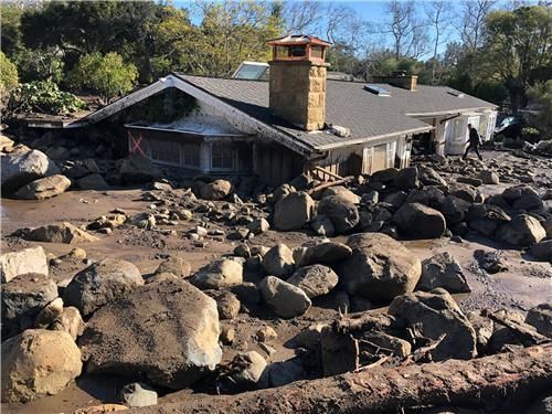
After a wildfire is extinguished, water flow in mountainous areas changes. As trees, grass, and leaf litter diminish, the ability to retain rainwater weakens. Soil with lost or weakened roots is prone to being washed away along slopes, and if the burnt soil surface cannot absorb water effectively, rainwater drags soil, ash, and stones downstream.
For this reason, wildfire-affected areas become dangerous again during the first heavy rains. Flows of soil and rocks originating from the mountains travel down valleys and streams, and in canyon entrances or on gentle terrain, they can spread widely toward houses and roads.
The United States Geological Survey (USGS) explains that debris flows following wildfires move rapidly down a stream mixed with water, rocks, soil, vegetation, and large stones. In areas with steep slopes, shallow landslides mix with water and accelerate, while in recently burned areas, debris flows can originate from slope erosion or riverbeds.
Montecito, Southern California, is a region that illustrates just how quickly damage from heavy rain can strike following a wildfire. In December 2017, the Thomas Fire burned more than 280,000 acres across Ventura and Santa Barbara County. On January 9, 2018, heavy rains triggered a debris flow in Montecito. This disaster killed 23 people and caused significant damage to homes and infrastructure.
Jonathan Gott, Coordinator of the USGS Landslide Hazard Program, stated in data released by the USGS in January 2018 that "debris flows following wildfires are particularly dangerous because they can occur even with very short periods of heavy rain." He explained that debris flows move rapidly and with great force, stripping away vegetation, blocking drainage systems, damaging structures, and threatening human lives.
Repeated heatwaves and heavy rains in Korea as well
Last summer in Korea also saw alternating heatwaves and heavy rainfall. According to the '2025 Abnormal Climate Report,' midsummer weather began in late June as the North Pacific High expanded early, and the influence of the Tibetan High was added in late July. The nationwide average summer temperature was 25.7 degrees Celsius, the highest since observations began in 1973.
The sweltering heat led to casualties. During the operation period of the heat-related illness emergency room surveillance system from May to September, there were 4,460 cases of heat-related illnesses and 29 deaths. As the heat wave dragged on, rain was concentrated in specific areas for short periods. At 15 locations, including Gapyeong and Seosan, the maximum hourly rainfall exceeded 100 mm. The human casualties resulting from localized torrential rains were tallied at 24 deaths and 1 missing person, while property damage amounted to 1.1307 trillion won.
As heatwaves and heavy rains alternated within the same summer, some regions even experienced water shortages. While the western region suffered from heavy rainfall, the Yeongdong region of Gangwon faced a severe drought. Summer precipitation in the Yeongdong region of Gangwon amounted to only 232.5 mm, which is 34.2% of the average. The water level at Gangneung Obong Reservoir dropped to 11.5%, the lowest level since its completion, and phased water rationing was implemented.
High-carbon scenario analysis... 'Forest Fire Danger Index' rises
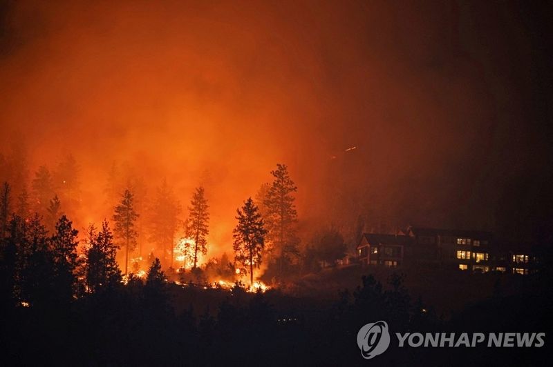
When heatwaves, droughts, and strong winds recur, the criteria for assessing wildfire risk also change. In a report titled "Future Forest Fire Danger Index to Increase Without Greenhouse Gas Reduction" released last June, the Korean Meteorological Administration analyzed the present and future of the Forest Fire Danger Index based on a detailed national climate change standard scenario for South Korea with a resolution of 1 km.
The Forest Fire Danger Index is a measure based on four meteorological elements—maximum temperature, relative humidity, precipitation, and wind speed—that indicates how quickly a wildfire can spread and intensify in the early stages of its occurrence. According to the Korean Meteorological Administration, over 70% of wildfires in Korea occurred during the spring months of February to May over the past 20 years (2000–2019). Wildfires occurred more than twice as frequently in the range exceeding the top 5% of the Forest Fire Danger Index compared to the mid-range.
Analysis shows that this index is projected to increase in future climates. Under a low-carbon scenario, Korea's average spring Forest Fire Danger Index increased by 29% from the current approximately 4.35 to about 5.62 in the second half of the 21st century. Under a high-carbon scenario without greenhouse gas reduction efforts, it increased by 43% to about 6.22.
A rising Forest Fire Danger Index means that the risk increases on days when high temperatures, low humidity, light precipitation, and strong winds coincide. Under these conditions, even a small spark can spread rapidly, and mountainous areas affected by fire become more vulnerable to debris flows and damage near rivers during subsequent heavy rainfall.
Korean Meteorological Administration Director Lee Mi-seon stated, "Due to rising temperatures caused by climate change, the likelihood of extreme values in the Forest Fire Danger Index occurring in the future is expected to be greater than it is currently."
[email protected] Han Seung-gon Reporter