Typhoon KROVANH Moves Away from Jeju Province, but Strong Winds and High Waves Continue... Up to 5 Meters in Southeastern Offshore Waters
- Input
- 2026-09-06 07:28:20
- Updated
- 2026-09-06 07:28:20
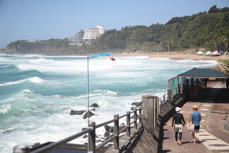
【Financial News Jeju=Jeong Yong-bok】 Strong winds and high waves are expected to continue for some time even as Typhoon No. 24 KROVANH moves away from Jeju Province. Up to 40 mm of additional rain is expected in the mountainous and mid-mountain areas of Jeju through the morning of the 7th, while waves reaching 5 meters are forecast in the offshore waters southeast of Jeju Province.
According to the Jeju Regional Meteorological Administration on the 6th, Jeju Province will be mostly cloudy, with occasional rain mainly in the mid-mountain and mountainous areas and the eastern part of Hallasan.
Rain will continue through the morning of the 7th, but frequent lulls are expected rather than continuous rainfall.
Rainfall through the morning of the 7th is expected to total 10–40 mm in Jeju Province’s mid-mountain and mountainous areas and 5–10 mm along the coast. Occasional rain is expected on the 6th, mainly in the eastern and southern areas, including Jeju Province, Seogwipo City, and Seongsan. Rain is also likely to continue through the morning of the 7th in mid-mountain and mountainous areas such as Sancheondan, Hannam, and Seongpanak.
Strong winds, rather than the amount of rain, will be the greater variable. Very strong northeasterly to easterly winds are expected in major areas of Jeju Province on the 6th, followed by strong northerly to northeasterly winds through the morning of the 7th.
Strong winds are expected to continue not only in Jeju Province, Seogwipo City, and Seongsan, but also in the mid-mountain and mountainous areas. Caution is needed in managing facilities and crops.
In particular, prolonged strong winds since the 4th have caused damage to facilities such as roadside trees and traffic lights. At the Port of Jeju, a crane overturned, resulting in casualties. As the strong winds have continued for an extended period, additional inspections are also needed for structures, signs, temporary construction-site facilities, and other installations already affected by the wind.
Weather conditions at sea are expected to recover more slowly than those on land. On the 6th, wave heights in the waters off Jeju Province were forecast at 1.5–4.5 meters. Waves were expected to reach up to 3.5 meters in the northern and western waters and up to 4.5 meters in the southern and eastern waters.
Conditions are rougher in the inner offshore waters southeast of Jeju Province and the outer offshore waters south of Jeju Province. Wave heights were forecast to reach 2–5 meters on the 6th and through the morning of the 7th.
Winds will also be strong. Northeasterly to easterly winds of 10–18 meters per second are expected in the inner offshore waters southeast of Jeju Province and the outer offshore waters south of Jeju Province.
As wave heights rise, strong swells may also reach the coast. People should beware of safety accidents near breakwaters, rocky shores, coastal roads, and other coastal areas.
Land-based weather will gradually recover from the afternoon of the 7th. Jeju Province will remain cloudy with rain through the morning of the 7th, followed by increasing clouds in the afternoon. From the 8th, conditions are expected to be mostly clear or partly cloudy.
The daytime high temperature in Jeju Province on the 6th is expected to reach 27–29°C, similar to or slightly higher than the seasonal average. On the 7th, temperatures are forecast to range from a morning low of 24°C to a daytime high of 27–29°C.
[email protected] Jeong Yong-bok Reporter