'National Standard Geological Information' National Basic Geological Map Completed After 100 Years
- Input
- 2026-09-10 14:00:00
- Updated
- 2026-09-10 14:00:00
[Financial News] The National Basic Geological Map, a standard map compiling geological information on South Korea’s territory, has been completed after approximately 100 years. It is expected to be widely used not only for land safety, resource and energy security, and disaster prevention, but also for urban development, including underground-space utilization.
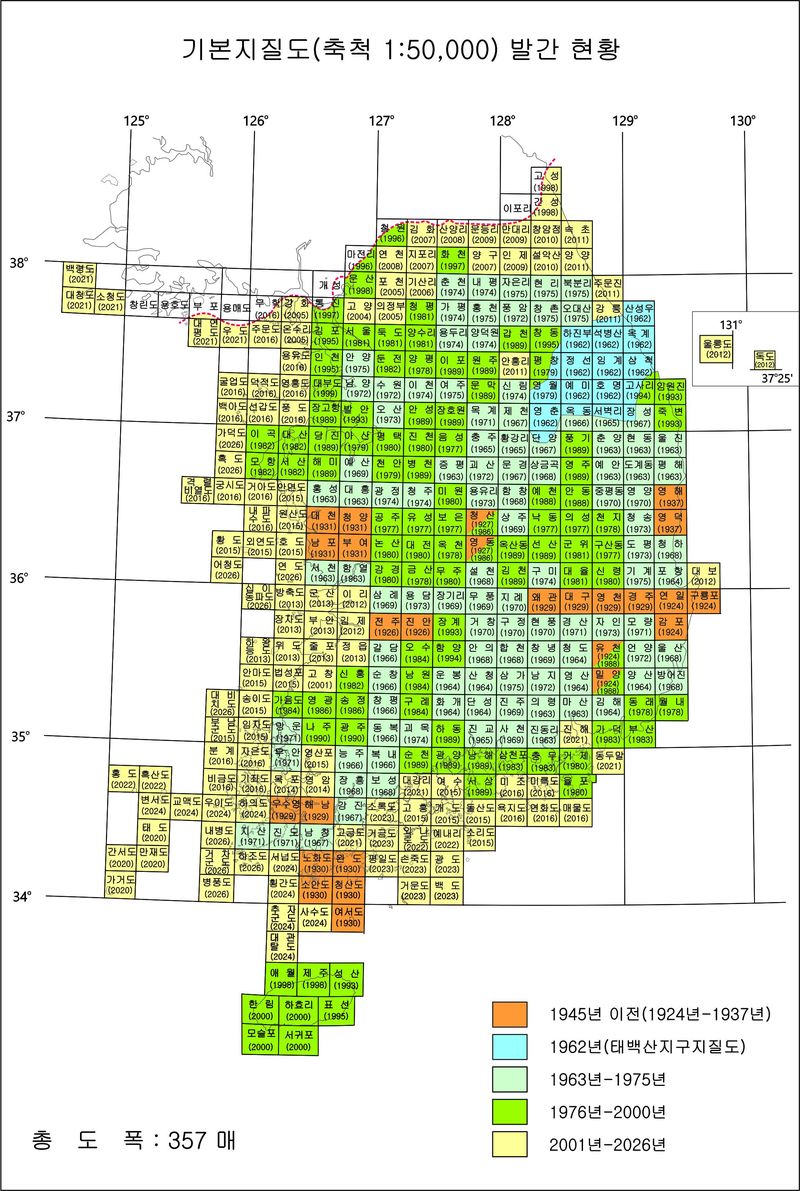
The Korea Institute of Geoscience and Mineral Resources (KIGAM) announced on the 10th that it had completed all 357 sheets comprising the southern part of the 1:50,000-scale National Basic Geological Map. This marks the completion of the project approximately 100 years after the first 1:50,000-scale geological map was published in 1924.
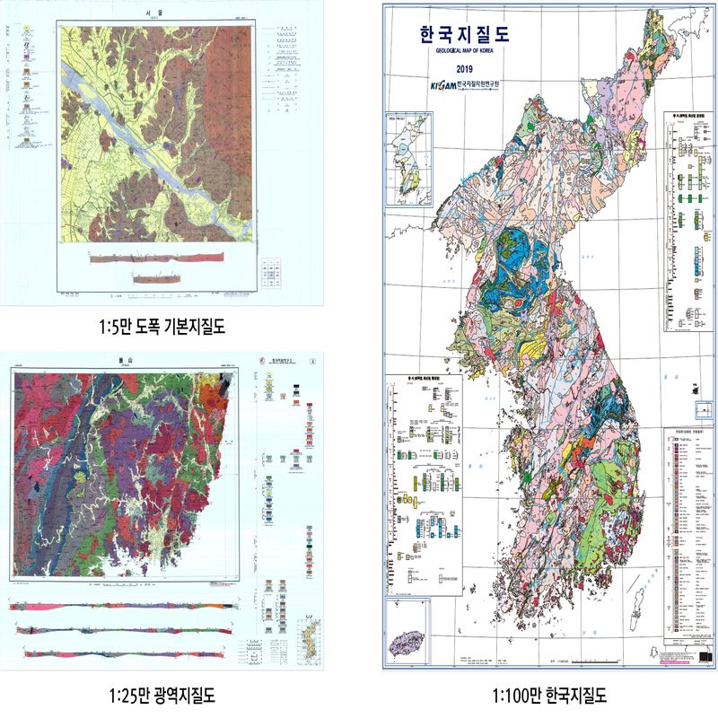
The National Basic Geological Map is South Korea’s national standard geological information, systematically recording on maps the types and formation periods of rocks making up the country, the distribution and relative sequence of strata, and geological structures such as faults and folds. Unlike ordinary maps, which show surface locations and terrain, it is often compared to a “history book of the land” because it also depicts the processes through which the present-day territory was formed. The 1:50,000-scale map serves as the basic map for uses such as road locations and resource information, while the 1:25,000-scale map, which contains more detailed information for industrial purposes, is also produced based on the 1:50,000-scale map.
Kwon Yi-gyun, president of KIGAM, said, “The completion of the National Basic Geological Map is a historic achievement that brings together the dedication of geologists who have walked and documented the country for more than 100 years, along with scientific and technological advances. Completing a single sheet takes two to three years and is work that only a small number of experts can perform. It is a meaningful completion that can stand comparison with the level of geological-map production in the United Kingdom, France, and Japan, whose geological conditions are similar to those of South Korea.”
France has completed its 1:50,000-scale geological map except for seven sheets, while its territory is larger than South Korea’s. Japan has completed 60% to 70% of its map, but is also producing three-dimensional geological maps. Although a direct comparison is difficult, the achievement is considered comparable to those of the two countries.

South Korea’s national geological surveys began with the establishment of a geological survey office in 1918 during the Japanese colonial period. They developed in earnest through the publication of the first 1:50,000-scale geological map in 1924 and the publication of the Taebaeksan District geological map in 1962 to secure energy resources. The maps were subsequently supplemented through field surveys and detailed analyses. In 2026, the final sheets covering mountainous, border, and island areas were completed, bringing all 357 sheets of the southern region together as a single National Basic Geological Map.
Lee Seung-ryeol, head of KIGAM’s Geological Survey Research Division, said, “We continued completing the geological map by introducing quantitative surveying equipment and improving accuracy through methods such as geochronology.” He added, “South Korea’s territory has geological structures oriented toward the southeast, a history of approximately 2.5 billion years, and an extremely complex geological system relative to its area.”
The completion of the National Basic Geological Map is expected to provide a scientific basis for using the country’s territory effectively, including resource and urban development and selecting sites for power-plant construction.
Following the completion, KIGAM will pursue the digital transformation and advancement of national geological information. It will conduct high-resolution res surveys and continuously update existing geological information, while incorporating newly identified geological data through the use of the latest survey and analysis technologies, artificial intelligence (AI), and other tools. In particular, beginning next year, it will move beyond surface-focused two-dimensional geological information to a national three-dimensional geological information system that represents underground structures in three dimensions. This is intended to reduce uncertainty regarding underground spaces, including subsurface resources, hazards, and potential uses.
[email protected] Yeon Ji-an Reporter