Typhoon KROVANH’s Indirect Effects Intensify... Strong Winds and Wind Shear at Jeju Airport, Some Ferry Routes Restricted
- Input
- 2026-09-04 06:39:05
- Updated
- 2026-09-04 06:39:05
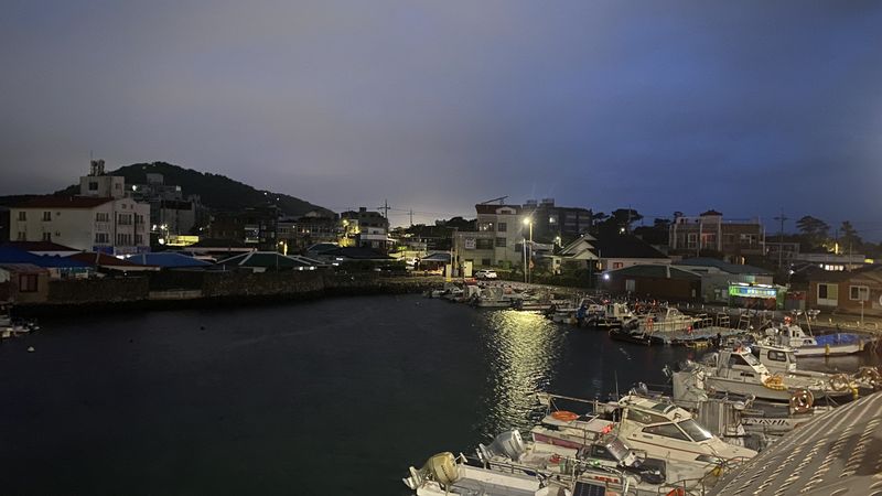
【Financial News Jeju = Jung Yong-bok】 Typhoon No. 24, KROVANH, is not heading directly toward Jeju, but its indirect effects—strong winds and high waves—have intensified. A strong wind advisory was issued for all of Jeju Province, while a high wave advisory was issued for all surrounding waters. Jeju International Airport was also under wind shear warnings for both takeoffs and landings, as well as a strong wind warning. Some passenger ferry services began to be restricted because of deteriorating weather conditions.
According to the Jeju Regional Meteorological Office and the Aviation Meteorological Office on the 4th, strong northeasterly to easterly winds were blowing over Jeju that morning under the influence of the pressure system surrounding the typhoon. A strong wind advisory was in effect across Jeju Province, and a high wave advisory was issued for all waters around the province.
Conditions at Jeju International Airport are also drawing attention. The Aviation Meteorological Office issued wind shear warnings for both takeoff and landing directions at the airport. A strong wind warning will remain in effect from 2 a.m. to 9 p.m. that day.
Wind shear is a phenomenon in which wind direction or speed changes suddenly over a short distance, potentially affecting aircraft takeoffs and landings. However, the issuance of wind shear or strong wind warnings does not automatically mean that flights will be canceled. Whether a flight operates will be determined by considering runway wind direction and speed, wind shear intensity, weather conditions at the departure and arrival airports, and aircraft operating conditions.
As morning flights get underway, whether cancellations, delays, or diversions actually occur will be a key factor affecting air traffic to and from Jeju that day.
Conditions at sea are rougher. According to the Jeju Regional Meteorological Office, waves in the waters off Jeju were forecast to reach 1.5–4.5 m that morning and up to 5 m in the afternoon.
In particular, waves in the waters off eastern Jeju Province were expected to reach 2.0–5.0 m in the afternoon, while those off the southern coast were also forecast at 2.0–5.0 m. Wave heights in the northern and western offshore areas were likewise expected to rise to as high as 4 m.
The high waves will continue through the 5th. Waves of up to 5 m are also expected on the 5th in the waters off eastern and southern Jeju Province.
Winds at sea could also reach 18 m per second, making it highly likely that ferry and fishing boat operations will be affected.
Ferry service restrictions have already begun. According to operating information from the Korea Maritime Transportation Safety Authority, the Songrim Blue Ocean, which was scheduled to travel from Jeju to Wando via the Chujado Islands, was restricted from operating at 8 a.m. that day because of deteriorating weather. As marine conditions can change rapidly, passengers should check the vessel’s operating status again immediately before departure.
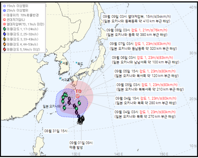
At 3 a.m. that day, KROVANH was moving northwest over waters about 270 km north of Okinawa.
Its central pressure was 992 hPa, its maximum wind speed was 23 m per second (83 km per hour), and its radius of strong winds was 250 km. Its movement speed was analyzed at 34 km per hour.
The typhoon was also moving north faster than forecast the previous day. In its forecast issued at 4 a.m. the previous day, the Korean Meteorological Administration had expected KROVANH to be at 28.6 degrees north latitude and 128.1 degrees east longitude at 3 a.m. on the 4th, moving at 18 km per hour. In the actual analysis, it had reached 29.0 degrees north latitude and 128.2 degrees east longitude, with its movement speed recorded at 34 km per hour.
However, the typhoon is not on a path that will carry it northward directly toward the Korean Peninsula. The Korean Meteorological Administration forecast that at 3 p.m. that day, KROVANH would turn west-northwest over waters about 280 km northwest of Okinawa, while its movement speed would drop sharply to 7 km per hour.
On the 5th, it is expected to move southwest and south before moving again around the waters near Okinawa. Under the current projected path, the center of the typhoon will not pass directly over Jeju.
For Jeju, the key concern is not the typhoon’s central path but the strong winds and high waves already being observed. Rain of 5–20 mm is expected in parts of Jeju through late afternoon that day. The morning probability of precipitation was forecast at 60% in Jeju and Seogwipo, and 70% in Seongsan, Sancheondan, Hannam, and Seongpanak.
From late afternoon through the night of the 5th, 5–20 mm of rain is expected mainly in the mid-mountain areas and mountainous regions. On the 6th, rain will spread across all of Jeju Province, with expected precipitation increasing to 10–60 mm. Rain is also forecast to continue in some areas from early dawn through the morning of the 7th.
Despite the strong winds, daytime temperatures will remain high at 28–30 degrees Celsius, above the seasonal average. Heat wave advisories are also in effect in western Jeju City and western and southern Seogwipo City.
The Korean Meteorological Administration said strong winds over Jeju and high waves and swells at sea are expected to continue for the time being. It urged residents and visitors to take particular care with facilities, coastal safety, and air and maritime transportation.
[email protected] Jung Yong-bok Reporter