Nine Koreans Missing in Nepal Floods; At Least 160 Dead
- Input
- 2026-08-27 08:14:54
- Updated
- 2026-08-27 08:14:54
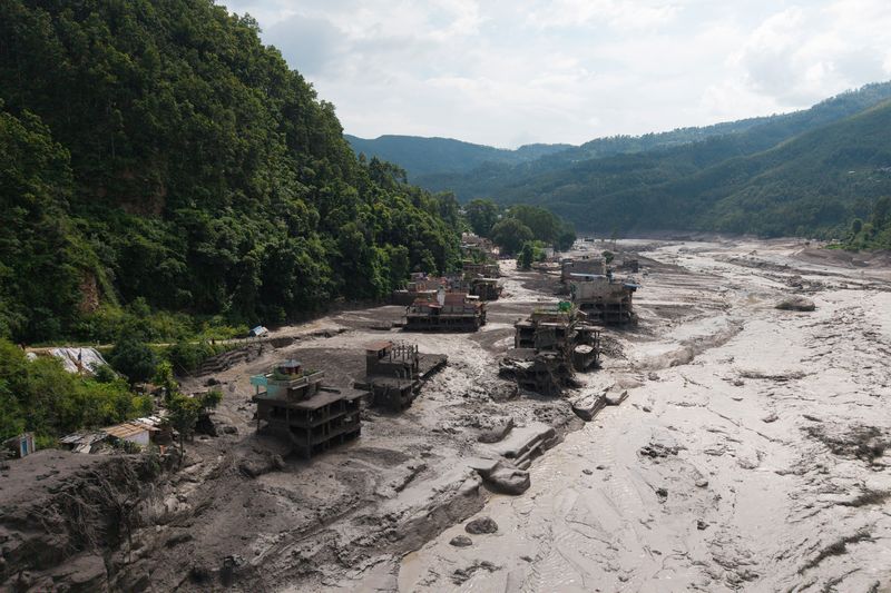
[Financial News] The damage from the massive flood in north-central Nepal near the Chinese border is growing worse. At least 160 people have died, and more casualties are expected as many remain missing.
According to foreign media outlets including the Associated Press (AP), Nepal police said on social media platform X on the 26th that at least 157 people had been killed so far in the major flooding in the central region. CCTV reported that at least three people were also killed in a landslide in Gyirong County, Xigaze City, in the Tibet Autonomous Region.
A massive flood struck parts of Bagmati Province in north-central Nepal at around 8:37 a.m. that day. Nepal's tourism ministry said 403 tourists are currently missing, including 341 foreigners, and that 28 police officers are also out of contact. China also reported 265 people missing.
Nine Korean nationals from Korea South-East Power Co., Ltd. and Doosan Enerbility are also missing after contact was lost near a hydropower construction site. The government plans to send a joint rapid response team made up of officials from the Ministry of Foreign Affairs, the National Fire Agency, and the National Police Agency to the area.
At least 19 bridges were washed away in the floods and landslides, and entire villages were buried under mud and debris.
The United States Geological Survey initially said the landslides and flooding were caused by a magnitude 4.4 earthquake. However, after further analysis later that day, it said the flood was triggered by a magnitude 5.2 glacier collapse.
The USGS explained, "A magnitude 5.2 seismic event occurred near the Nepal-China border." It added, "We determined that the event was caused by a glacier collapse and debris flow, which triggered a chain of catastrophic downstream impacts." The agency said the incident had initially been reported as a magnitude 4.4 earthquake, but that additional analysis of nearby seismic stations, long-period seismic waves, and satellite images led it to conclude that no earthquake had occurred.
Experts said a large ice-and-rock collapse in the highlands may have temporarily blocked the Lende River. When the blocked water suddenly broke through, water and debris may have rushed downstream all at once. According to analysis of data from commercial satellite imagery firm Planet Labs and expert materials, satellite images showed signs that part of a glacier at an altitude of about 5,200 meters broke off and fell roughly 1,200 meters into the valley below.
[email protected] Park Jong-won Reporter