Typhoon Saudel expected to intensify to Category 4 strength... heading toward waters far south of Jeju on the 27th
- Input
- 2026-08-22 06:58:13
- Updated
- 2026-08-22 06:58:13
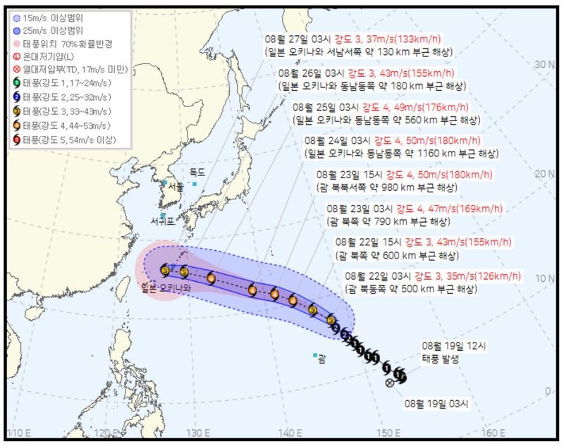
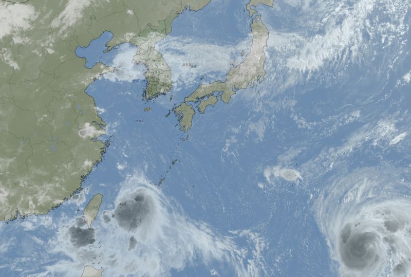
[Financial News, Jeju = Jung Yong-bok] Typhoon Saudel, the 18th typhoon of the season, is rapidly strengthening as it moves northwest. If the current forecast holds, it is expected to intensify to Category 4 on the 23rd and 24th, pass near Okinawa, then move westward and reach waters far south of Jeju by the 27th.
According to the Korean Meteorological Administration on the 22nd, Saudel was moving north-northwest at 23 km/h over waters at 17.0 degrees north latitude and 147.7 degrees east longitude as of 3 a.m. that day.
Its central pressure was 970 hPa, and maximum winds near the center reached 35 m/s. The radius of strong winds was estimated at 340 km. Under the 2026 typhoon intensity classification used by the Korean Meteorological Administration, it corresponds to Category 3.
The concern is that the storm is expected to strengthen sharply over the next day or two. By 3 p.m. on the 22nd, Saudel is forecast to deepen to 950 hPa with maximum winds of 43 m/s. By 3 a.m. on the 23rd, it is expected to rise to Category 4 with maximum winds of 47 m/s.
Between the afternoon of the 23rd and the morning of the 24th, central pressure is expected to fall to 930 hPa, while maximum winds could reach 50 m/s.
Category 4 refers to a typhoon with maximum winds of at least 44 m/s but less than 54 m/s. Under the classification previously used by the Korean Meteorological Administration, this would be considered a very strong storm.
Its track is also worth watching from Jeju's perspective. Saudel is expected to move northwest through the 23rd, then turn west-northwest and reach around 22.7 degrees north latitude and 138.6 degrees east longitude by the morning of the 24th.
By the morning of the 25th, it is forecast to be near 24.8 degrees north latitude and 133.2 degrees east longitude, and by the morning of the 26th, near 25.8 degrees north latitude and 129.5 degrees east longitude. On the 26th, it is expected to move into waters near Okinawa. At this stage, it is too early to conclude that a typhoon will hit Jeju Province.
Typhoon track forecasts become less certain the farther out they go. The '70% probability radius' shown on the Korean Meteorological Administration's track map means there is a 70% chance the center of the typhoon will be within that area. It does not mean the storm will move only along the exact center line of the forecast path.
The key variable in the later track is the pressure pattern around the typhoon. The storm's direction and speed could change depending on how much strength the North Pacific High maintains and how quickly the trough to the north moves. The Korean Meteorological Administration has also said it is difficult to determine a specific track for whether Saudel will affect South Korea.
Still, because Saudel is expected to approach Okinawa and then move west after developing into a Category 4 storm, changes in its track between the 25th and 27th are likely to be an important weather factor for Jeju Province as well. If the track shifts northward, it could directly affect winds and waves over the waters south of Jeju.
[email protected] Jung Yong-bok Reporter