Extreme heat in the Capital Region nears 104 degrees Fahrenheit... Even if the weekend cools a bit, "the peak is still ahead"
- Input
- 2026-08-06 16:31:01
- Updated
- 2026-08-06 16:31:01
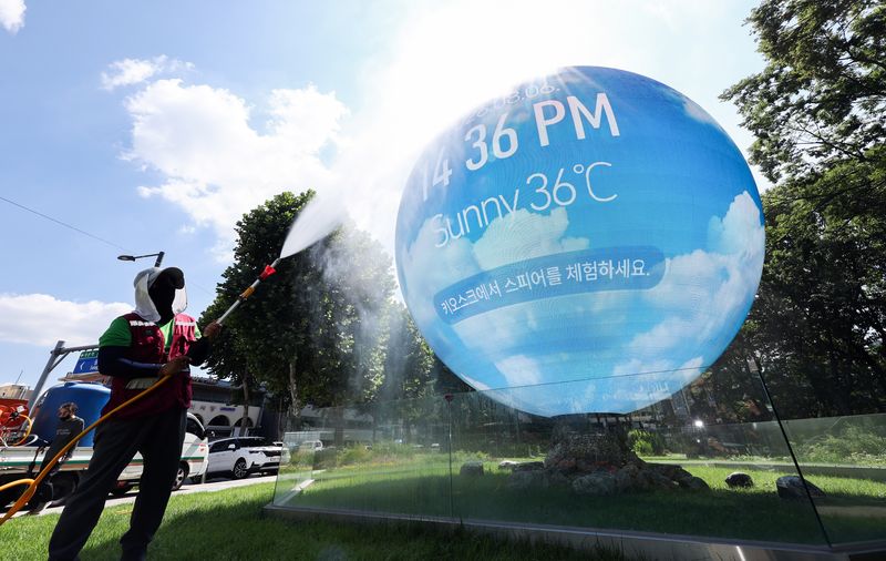
News] Extreme heat nearing 104 degrees Fahrenheit is expected to continue through Aug. 7, the Start of Autumn, centered on Seoul and other parts of the Capital Region. Temperatures will ease somewhat over the weekend, but the scorching weather is likely to continue at heat-wave warning levels through next week. The Korea Meteorological Administration (KMA) said Typhoon No. 13, Dolphin, may temporarily slow the rise in temperatures as it moves, but it is not expected to affect the heat wave significantly.
At a regular briefing on the 6th, Lee Gwang-yeon, a forecast analyst at the KMA, said, "A high-pressure system linked up to the upper atmosphere is staying over the Korean Peninsula, and clear weather is continuing." He added, "Very hot weather is expected to continue through the 7th, especially in western areas."
According to the KMA, Seoul's daytime high reached 37.4 degrees Celsius at 3 p.m. that day. In Guro District and Nowon District, temperatures rose to 38.9 degrees and 38.6 degrees, respectively.
Gimpo recorded the highest daily apparent temperature among major observation points at 38.4 degrees. Hanam-si's Deokpung area reached 38.2 degrees, and Fortune's Changsu area hit 38.0 degrees. Panmunjom in Paju and Namchon in Osan also climbed to 37.6 degrees. In inland Gangwon Province, where an emergency heat alert has been issued, the apparent temperature also hovered around 37 degrees.
The extreme heat is expected to weaken somewhat starting this weekend. At present, a high-pressure system stretches vertically from the surface to about 12 kilometers above ground, covering the Korean Peninsula.
The analyst explained, "As the link between the mid- and lower-atmosphere high-pressure system and the upper-level system weakens, the center of the high-pressure system will move northwest." He added, "Rain is expected along the East Coast of Korea, while sunlight will be somewhat weaker in other areas."
As a result, Seoul's temperature is expected to fall to 36 degrees over the weekend, about 3 degrees lower than the previous day. Still, temperatures around 35 degrees nationwide will remain at heat-wave warning levels, making the weather feel very hot.
Heavy rain is expected along the East Coast of Korea over the weekend. Easterly winds from the East Sea will pass over warm waters with sea surface temperatures above 27 degrees Celsius, absorb large amounts of moisture, and then collide with the Taebaek Mountains to form strong rain clouds. Woo Jin-gyu, a KMA forecaster, said, "The Yeongdong region of Gangwon Province could see up to 120 mm of rain in some places on the 8th alone, so caution is needed."
Typhoon No. 13, Dolphin, is not expected to directly affect South Korea. It is likely to pass Okinawa Prefecture on the 7th and make landfall near the southern coast of Shanghai around the 10th. Woo said, "As the typhoon moves through the East China Sea and toward southern China, cloud cover may increase somewhat in the Yeongdong region of Gangwon Province as well as in the southern part of the country, which could lower temperatures." He added, "But this would be only a temporary effect while the typhoon passes nearby, and the heat is likely to return afterward."
Another variable is how the East Asian pressure pattern will be reorganized after the typhoon makes landfall in mainland China.
Woo said, "The peak strength of the North Pacific High and the Tibetan High usually comes in mid- to late August. As the East Asian pressure pattern is readjusted after the typhoon passes, the two high-pressure systems may settle back into place, making it possible for intense heat to return." He added, "It is still too early to say that the peak of the heat wave has passed."
[email protected] Lee Bo-mi Reporter