Heat Wave Alert Raised to Highest Level Across Seoul... High of 38 C During the Day [FN Weather]
- Input
- 2026-08-04 09:24:28
- Updated
- 2026-08-04 09:24:28
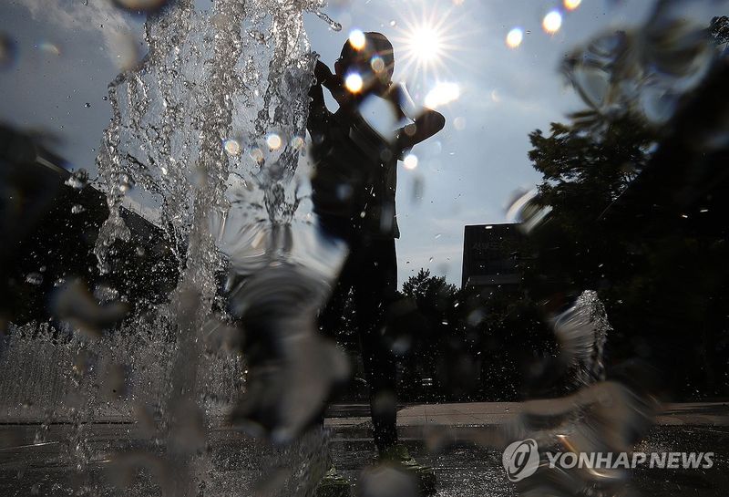
[Financial News] For the first time, the highest level of heat wave warning, the Severe Heat Wave Alert, will be issued across all of Seoul. After first taking effect in the city’s southwest and southeast districts the previous day, it will be expanded to the northwest and northeast districts at 11 a.m. on the 4th. In Seoul and parts of the Capital Region, temperatures are expected to rise above 39 C, or the perceived temperature may exceed 38 C, creating life-threatening heat.
According to the Korea Meteorological Administration (KMA), Severe Heat Wave Alerts are also in effect in Gyeonggi's Hanam and western Osan and Yeoju, as well as in Jeonnam-Gwangju Integrated Metropolitan City’s Jangseong County, Boseong County, Yeosu, Suncheon, Gwangyang, northern and southern Gokseong, and eastern Gwangju.
The Severe Heat Wave Alert is the highest level of heat warning introduced this year. It is issued when the perceived temperature stays at 35 C or higher for at least two days and then rises to 38 C or above, or when the daily high is forecast to reach 39 C or higher.
In Seoul, the alert was first issued for the southwest and southeast districts the previous day and was expanded to the remaining areas on this day. The center of the extreme heat, which had been concentrated in the southern part of the country, has shifted west of the Baekdu-daegan, including the Capital Region.
The shift in the heat center is due to easterly winds. A high-pressure system in the middle and upper atmosphere moved northward from the previous day and settled near North Korea, bringing easterly winds into South Korea.
Air flowing in from the East Sea becomes hotter as it crosses the Baekdu-daegan and descends the western slopes, where it is compressed. This is known as the foehn effect. As a result, temperatures in western areas, including the Capital Region, will rise sharply, while the east coast of Gangwon Province and northern Gyeongbuk, where easterly winds blow in directly from the sea, will be relatively cool. Heat warnings in those areas have also been lifted.
Temperatures are rising quickly from the morning. As of 8 a.m., Busan recorded the highest temperature at 31.4 C, followed by Daejeon at 30.7 C, Gwangju at 30.6 C, and Seoul at 30.2 C, all already above 30 C. Incheon recorded 29.2 C, Daegu 28.7 C, and Ulsan 28.4 C.
The daytime high nationwide is forecast to range from 30 C to 38 C. Seoul and Gwangju are expected to reach 38 C, while Incheon and Daejeon may climb to 37 C. Daegu is forecast at 36 C, and Ulsan and Busan at 34 C. Even in areas without a Severe Heat Wave Alert, the perceived temperature is expected to hover around 35 C in most places.
Showers are also expected mainly in western areas. As moisture from the East Sea moves in on easterly winds, the land heated by the midday sun rises, and relatively cool air from the sea moves in as a sea breeze to fill the gap. The collision between the sea breeze and the easterly wind is expected to develop rain clouds.
From the afternoon to evening of the 4th, Honam is expected to receive 5 to 60 mm of showers. Southern Gyeonggi, the Chungcheong Region, the inland areas of western Gyeongbuk, and the inland areas of western Gyeongnam are forecast to get 5 to 40 mm, while Jeju’s mountainous and mid-mountain areas may see around 5 mm. Gusty winds, thunder, and lightning may accompany the showers.
Temperatures will temporarily dip while the showers fall, but the heat will not ease. After the rain stops, temperatures may rise again in the high humidity, making the heat feel even more intense. Because nighttime temperatures are not expected to fall enough, tropical nights are likely to continue in many areas.
[email protected] Lee Bo-mi Reporter