Will It Get Hotter, or Sweep Everything Away? The Korean Peninsula, Trapped in a Heat Wave, Hangs on Typhoon Dolphin
- Input
- 2026-08-03 08:02:17
- Updated
- 2026-08-03 08:02:17
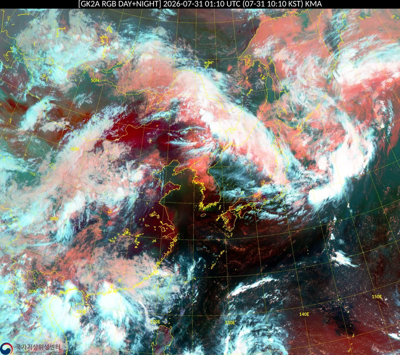
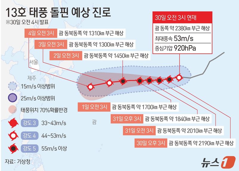
[Financial News] As record-breaking heat continues nationwide, Typhoon No. 13, Dolphin, which has maintained a "very strong" intensity, is moving north and has emerged as the biggest variable for weather conditions on the Korean Peninsula next week.
According to the KMA on the 2nd, Typhoon Dolphin was passing through waters about 1,270 km northeast of Guam at 3 a.m. that day and moving northwest. It is still maintaining top-tier strength, with a central pressure of 930 hPa and maximum sustained winds of 50 m/s.
The KMA said Dolphin is expected to move to waters near Okinawa Prefecture, Japan, by the middle of next week, after which its final track will depend on changes in the strength of the North Pacific High. It remains unclear whether the storm will directly affect South Korea, but its path could significantly alter the pattern of the heat wave.
If the typhoon heads toward eastern China, hot and humid air along its outer edge could pour in, likely intensifying the current heat wave, which already feels hotter than 35 degrees Celsius. On the other hand, if it moves north over waters closer to the Korean Peninsula, clouds and rain could temporarily ease the heat.
What is worrying is Dolphin's strength. Its intensity is comparable to Typhoon Rusa in 2002, which caused massive damage and brought 871 mm of rain in a single day in Gangneung, or Typhoon Maemi in 2003, which produced maximum winds of 60 m/s and caused damage worth more than 4 trillion won.
Meanwhile, the KMA forecast that from the 5th to the 11th, the entire country will remain under the influence of the North Pacific High, bringing muggy heat and tropical nights for the time being, with morning lows of 23 to 27 degrees Celsius and daytime highs of 32 to 37 degrees Celsius.
A KMA official said, "Temperatures and precipitation patterns may change depending on the typhoon's track and shifts in the surrounding pressure systems." The official added, "Once the path becomes clearer early next week, the storm's impact on South Korea and whether the heat wave will continue will become more apparent," and urged the public to pay close attention to weather updates.
[email protected] Moon Young-jin Reporter