Korea's First Agricultural Satellite Heads to Space, Makes First Contact at 7:05 p.m.
- Input
- 2026-07-07 19:40:04
- Updated
- 2026-07-07 19:40:04
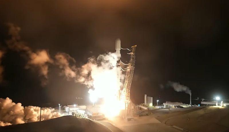
[Financial News] Korea's first agricultural satellite, Next-Generation Medium-Sized Satellite No. 4 (CAS500-4), made its first contact with a ground station at 7:05 p.m. on the 7th, after being launched into space. The satellite was jointly developed by the Korea AeroSpace Administration (KASA), the Rural Development Administration (RDA), and the Korea Forest Service.
Satellite No. 4 was successfully launched at 4:12 p.m. that day from Vandenberg Space Force Base in California. About 2 hours and 30 minutes after liftoff, it separated from the launch vehicle at an altitude of about 888 kilometers. About 23 minutes later, at 7:05 p.m. Korea time, or 2 hours and 53 minutes after launch, it successfully made its first contact with Norway's Svalbard ground station. During its initial operations period, Satellite No. 4 will use two overseas ground stations: the Svalbard ground station in Norway and Antarctic King Sejong Station.
KASA confirmed through contact with the ground station that Next-Generation Medium-Sized Satellite No. 4 is in good condition. It also verified that the satellite has successfully entered a sun-synchronous orbit. With a wide observation swath of 120 kilometers and a resolution of 5 meters, Next-Generation Medium-Sized Satellite No. 4 is optimized for agricultural observation on the Korean Peninsula and forest information monitoring. It can image the entire country every three days and generate visual data. The satellite is also significant because it was developed under private-sector leadership using the standard platform secured during the development of Next-Generation Medium-Sized Satellites Nos. 1 and 2.
RDA Administrator Lee Seung-don said, "This success marks an important turning point for our agriculture, moving beyond experience and intuition toward data-driven precision farming." He added, "It opens an era in which we can monitor agriculture from the sky based on the national agricultural observation system." He continued, "By combining satellite imagery with artificial intelligence (AI), we will further advance crop yield forecasting and responses to agricultural disasters, and realize digital agriculture that farmers can feel on the ground."
[email protected] Choi Yong-jun Reporter