Defense Ministry to Shift Civilian Control Line North by an Average of 2 km, Push to Ease and Lift Protected Zones Covering 240 Times Yeouido
- Input
- 2026-06-17 10:36:11
- Updated
- 2026-06-17 10:36:11
The ministry also plans to lift restricted protection zones covering an area about 150 times the size of Yeouido. The ministry said on the 17th that it will push ahead with reforms to military facility regulations. The measures were drawn up as a comprehensive package involving the ministry, the Republic of Korea Joint Chiefs of Staff (ROK JCS), and units under the Operations Command.
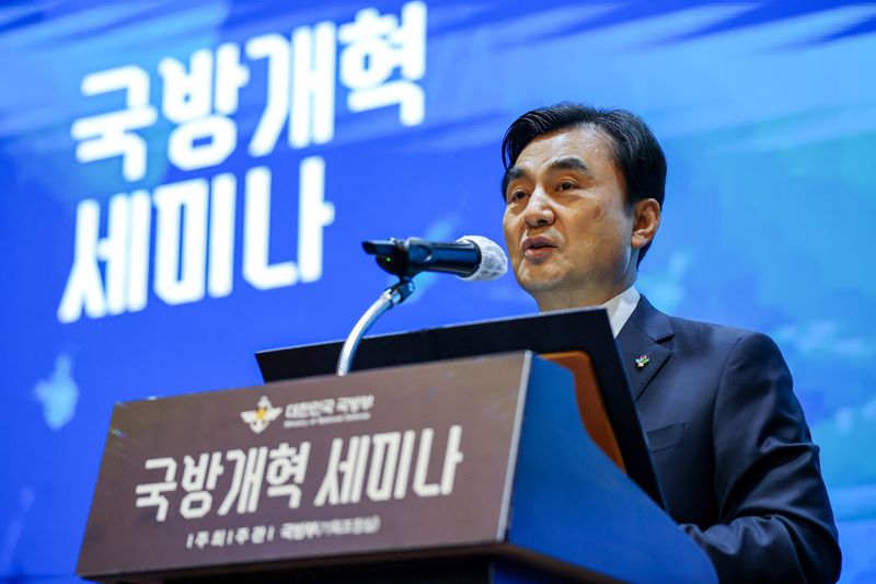
At the briefing that day, Minister of National Defense Ahn Gyu-back said, "We have prepared a plan to adjust the Civilian Control Line so that we can respond to the future security environment, including a decline in military manpower. " He added, "We will strengthen control measures and gradually adjust the Civilian Control Line starting in 2027. " The ministry said it will move the Civilian Control Line north to an average of 6 km from the Military Demarcation Line (MDL).
At present, the line varies by region because of differences in terrain. On average, it is set 8 km south of the MDL. If the line is shifted north by about 2 km on average, an area about 90 times the size of Yeouido, or roughly 270 square kilometers, will be reclassified from a "controlled protection zone" to a "restricted protection zone.
" The ministry said, however, that the Civilian Control Line will not be moved north uniformly across all areas. The standards for restricted protection zones will also be reset.
After an optimization process that takes into account the protection distance needed for each military base and actual operational factors, the ministry plans to lift restrictions on an area of about 450 square kilometers, or roughly 150 times the size of Yeouido. Through the Civilian Control Line adjustment and the reset of restricted protection zone standards, the total area of protected zones to be eased or lifted will amount to 240 times the size of Yeouido.
1% of the country's total land area designated as military facility protection zones, or 7,900 square kilometers. If the restricted protection zone is lifted, regional development will be possible.
The move is expected to help protect property rights for residents in border areas of Gyeonggi and Gangwon Province and promote regional development. The government also decided to reorganize military obstacles that have caused traffic congestion and other problems as border regions become more urbanized and the floating population grows.
Accordingly, in 2027, it plans to remove 23 sites first, including those in Paju and Yanggu County, where military usefulness has declined among obstacles that local governments have requested to be dismantled. It also plans to conduct a full survey in the second half of 2026, establish annual improvement plans in a systematic way, and continue consultations with local governments.
Digital standardization of access administration will also be pushed forward. The Civilian Control Line access system, which has long been operated through in-person procedures and handwritten forms, causing waiting times and administrative delays at the site, will be completely overhauled into an internet- and mobile app-based system.
The ministry plans to quickly complete a concept study for system design this year in order to build an early access management system that minimizes identity verification time through simple authentication, and to begin full-scale system construction in 2027. Approval and authorization procedures for agricultural drones, which have become an essential tool for farmers, will also be greatly simplified.
Military authorities will expand the scope of flight approvals far beyond the current parcel-based system to administrative units such as myeon and ri, excluding only essential control elements in border areas for the convenience of residents. They will also accept advance approval requests twice a year in six-month units, allowing flights within approved areas with only a one-day-ahead authorization request.
In addition, the number of required documents will be reduced from seven to five. Customized infrastructure cooperation will also be introduced to support local governments' regional development projects.
Military idle land information, which had been difficult to use because verification was limited, will be provided in a tailored manner after local governments survey their needs and identify sites that meet the requirements. The information will be provided regularly twice a year, in the first and second halves of each year.
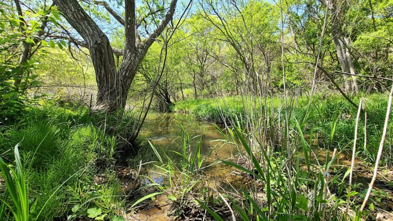
On August 22, 2023, the Korea National Arboretum said that the DMZ Ecology Research Institute had discovered nine new forest wetlands inside the Civilian Control Line in central border areas, including Yeoncheon County, Gyeonggi Province, and Cheorwon County, Gangwon Province. The photo shows a forest wetland inside the Civilian Control Line in Yeoncheon County, Gyeonggi Province.
wangjylee@fnnews.com Lee Jong-yoon Reporter