Morning commute to feel below -20°C: longest cold wave of the season coming next week
- Input
- 2026-01-18 16:02:30
- Updated
- 2026-01-18 16:02:30
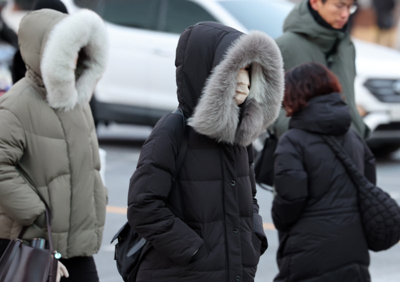
[The Financial News] As the weekend passes, temperatures are forecast to drop sharply, bringing the longest and most intense cold wave of this winter from January 20, Daehan (Major Cold), the last of the 24 solar terms. Strong winds will drive in cold air, sending the wind chill in Seoul down to around minus 21 degrees Celsius. Authorities are urging thorough preparations for transportation, heating and overall daily-life safety amid the prolonged cold.
According to the Korea Meteorological Administration (KMA), snow or rain is expected to begin in Gangwon State on the night of the 18th. Between the early hours and the morning of the 19th, about 1 centimeter of snow or light rain is forecast, mainly in central regions and Jeonbuk State. Although precipitation amounts will be small, temperatures will plunge rapidly after the rain and snow stop, creating a risk of black ice and icy patches on roads during the morning commute.
From the night of the 19th, after the snow and rain clear, a mass of cold air will begin to move down in earnest from the north, marking the start of a severe cold spell. On the morning of the 20th, Daehan (Major Cold), the temperature in Seoul is expected to drop by more than 10 degrees from the previous day to around minus 13 degrees Celsius, likely the lowest so far this winter. On the 21st, strong northwesterly winds will intensify the cold, and the wind chill in Seoul could fall to around minus 21 degrees. In some parts of the greater Seoul area, including Paju, Gyeonggi Province, the perceived temperature may drop to around minus 23 degrees.
On the 22nd, morning lows are forecast to range from minus 15 to minus 7 degrees, with daytime highs between minus 4 and plus 3 degrees. From the 23rd to the 24th, morning temperatures are expected to range from minus 14 to minus 3 degrees, and daytime highs from minus 2 to plus 5 degrees. Between the 25th and 28th, morning lows will likely range from minus 13 to 0 degrees, with daytime highs between minus 3 and plus 7 degrees.
Gong Sang-min, a forecasting analyst at the Korea Meteorological Administration (KMA), explained, “A pressure pattern bringing cold air from the northwest will persist throughout next week, causing minimum temperatures in inland areas to fall to around minus 15 degrees Celsius. Due to the strong winds, the wind chill will remain lower than the actual air temperature, and the severe cold will continue.”
Forecast analyst Gong Sang-min said, “A west-high, east-low pressure system, with high pressure to the west and low pressure to the east, has formed, maintaining northwesterly winds throughout next week and making a prolonged cold spell highly likely. Compared with the minimum temperatures recorded around Christmas and early this year, it could be similar or slightly lower, and the duration of this cold spell is expected to be even longer.”
The current cold wave is expected to last at least about six days and could persist even longer. With strong northwesterly winds on top of that, the wind chill is forecast to feel about 5 to 10 degrees colder than the actual air temperature.
Gong Sang-min noted, “We expect the cold wave to peak around the middle of next week, then gradually ease as the blocking to the east weakens somewhat around the 26th. However, even after the cold wave relaxes, temperatures are likely to remain below seasonal norms, so continued precautions against the cold will be necessary.”■ “Beware of frozen pipes and wildfires”Snow is likely to continue mainly along the west coast of Jeolla around the 21st–22nd and again around the 24th. This snow could extend to nearby areas, including the West Coast of Chungcheongnam-do.
Strong winds and high waves are also expected to persist for an extended period over seas, coastal regions and mountainous areas, which could disrupt flights and passenger ship operations. Travelers using these routes are advised to check in advance whether services are operating.
With a prolonged cold wave coinciding with very dry air, concerns are growing over frozen water pipes, damage to facilities and icy roads. Dry weather advisories have been issued mainly for eastern regions, and combined with strong winds, the risk of wildfires and structural fires is rising, calling for extra caution. As the use of heating devices increases, flammable items should be kept away from heaters, and it is advisable to check electrical and gas systems before going out.
The KMA has urged elderly people and children, who face a higher risk of hypothermia, to minimize outings during the coldest hours. It also called for particular caution against slip-and-fall accidents and other safety incidents on the way to work and in daily life.
spring@fnnews.com Lee Bo-mi Reporter