‘Bangudae Petroglyphs Eventually Submerged’… Even UNESCO Could Not Prevent the Torrential Rain
- Input
- 2025-07-19 12:56:36
- Updated
- 2025-07-19 12:56:36
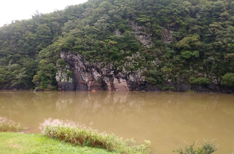
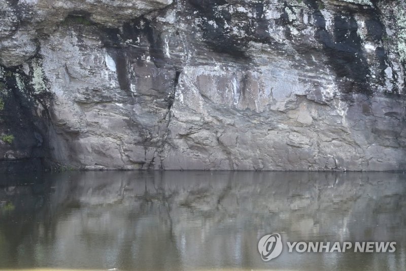
[Financial News] The Bangudae Petroglyphs in Ulsan, Ulju-gun, were submerged again just a week after being listed as a UNESCO World Heritage Site.
On the 12th, the Bangudae Petroglyphs, which were listed as a World Heritage Site as the ‘Petroglyphs of Bangudae Stream,’ were largely submerged on the morning of the 19th due to heavy rain.
As of 9 a.m. that day, the water level of the Sayeon Dam reached 56.19m. The Bangudae Petroglyphs, measuring 8m wide and 4.5m high, are located at an elevation of 53~57m, and at the current water level, most of it is submerged.
The Sayeon Dam is located about 4.5km upstream from the Bangudae Petroglyphs along the Daegokcheon. Due to the natural overflow dam structure without a water level control gate, when the reservoir is full, it affects the downstream petroglyphs.
Recently, localized heavy rain has hit the Ulju-gun area. According to the Korea Water Resources Corporation's measurements, 117.8mm of rain fell on the 13th, 59mm on the 14th, and 123.2mm on the 17th.
The dam water level started at 46.96m on the 12th and rose to 49.48m by the 15th. It briefly fell to 49.36m on the 16th, but with over 100mm of rain continuing for two days from the 18th, it surpassed 53m at 5 a.m. on the 19th.
Inflow Exceeds Discharge… Water Level Control Limitations
The Korea Water Resources Corporation continuously discharges domestic water to the Cheonsang Water Purification Plant from the Sayeon Dam to keep the dam water level low. During rain forecasts, industrial water is also additionally discharged to manage the water level.
However, during short-term heavy rain, the inflow to the dam greatly exceeds the discharge. On the 17th, the inflow was 31 tons per second, while the discharge was only 4.5 tons.
More than 50mm of rain is forecast until the afternoon of the 19th, so the dam water level is expected to continue rising. It will take considerable time for the water level to drop again, making it difficult for the World Heritage Bangudae Petroglyphs to escape the submerged state for the time being.
Average 42 Days of Submersion Annually… Urgent Need for Fundamental Solution
The previous submersion lasted for 74 days from August 10 to October 22, 2023, due to the influence of the rainy season and typhoons. In 2024, there was no rainfall sufficient to cause submersion damage.
From 2014 to 2023, the number of days the petroglyphs were submerged averaged 42 days annually. Before the active water level control by the Korea Water Resources Corporation, from 2005 to 2013, they were submerged for an average of 151 days annually.
To solve the problem of petroglyph damage due to submersion, a plan to install gates on the dam spillway was established in 2021. By installing three gates, each 15m wide and 7.3m high, the dam water level can be maintained at 52m, lower than the petroglyphs.
If all procedures proceed smoothly and construction begins in the second half of next year, it is expected to be completed around 2030. However, if heavy rains continue until then, the damage to the petroglyphs may worsen, highlighting the need for prompt preservation measures.
ahnman@fnnews.com Ahn Seunghyun Choi Susang Reporter